Sunday, December 20, 2020

10 New Discoveries for 2021

A view from the Indian Crossway trail in Hanson.

As challenging a year as it was, one of the upsides of 2020 was that it gave us increased opportunities to spend time outdoors. We are so fortunate, here on the South Shore, to have a seemingly endless supply of parks, preserves, and conservation areas.
 

 Last year each of these Nature columns was devoted to a specific town, highlighting some of the best walking places to be found there. This year we’ll be returning to more varied themes, with the continued intention of introducing you to, or reacquainting you with, a wide variety of places to hike, to fish, to paddle . . . or just to enjoy the view. 


Be sure to check out NSRWA’s Explore South Shore contest, which has been extended for another full year. We’ll be branching out a little farther across the region this year, featuring properties both within and beyond the watershed of the North and South Rivers. Each week we’ll highlight a new property to explore, and encourage you to visit, and post a photo from your adventure to Instagram with the hashtag #ExploreSouthShore2021. Once a month, we’ll randomly select a winner and award a prize. 


I’m so excited to share this month’s column with you! Below is a list of ten places I discovered only recently. Some of them are new, some are just new-to-me, and some were improved in one way or another over the past year. I hope you’ll enjoy exploring them!


Nathaniel Thomas Mill

Not far from the Hanson Town Hall, across from Wampatuck Pond on Route 58, stands this historic structure. Indian Head Brook flows from the pond, under the roadway, right past -- and through -- this renovated sawmill. If -- like me -- you’re fascinated by flowing water, you’re going to enjoy just standing on the observation deck, looking down into the brook as it passes by. The 1.3-acre property is small but mighty. A short walk down one side brings you to the edge of the brook, which flows through Hanson into the Indian Head River, one of the North River’s most significant tributaries. Ample on-site parking on Liberty Street in Hanson. 

Visit: https://www.nsrwa.org/listing/nathaniel-thomas-mill/


Cavern Rock Park

What an unexpected delight it was, to discover this unusual 36-acre property! Cavern Rock Park was acquired by the Town of Weymouth in 1968. It stands out among other local offerings because of its challenging 0.7-mile loop trail, which snakes through an oak forest, and features numerous granite outcroppings, many covered with moss. The steep trail is not for everyone. You won’t need ropes and carabiners, but if you enjoy scrambling over large boulders, be sure to check this place out. The land here drains to Whitman’s Pond, one of the headwaters of the Weymouth Back River, which flows for 10 miles to Hingham Bay. On-site parking for 3 cars on Westminster Road.

Visit: https://www.nsrwa.org/listing/cavern-rock-park/


Lapham Woods

Forward thinking by the Duxbury Rural and Historical Society preserved this 36-acre woodland for posterity in 1931 and 1952. Located on both sides of Depot Street, where it intersects with Tremont (across from the Town Offices), it provides a broad swath of pine forest within a busy part of town. There are several trailheads, and about 1.5 miles altogether of trails. The land here lies within the watershed of Bluefish River, which drains to Duxbury Bay. Limited roadside parking on Depot Street. 

Visit: https://www.nsrwa.org/listing/lapham-woods/
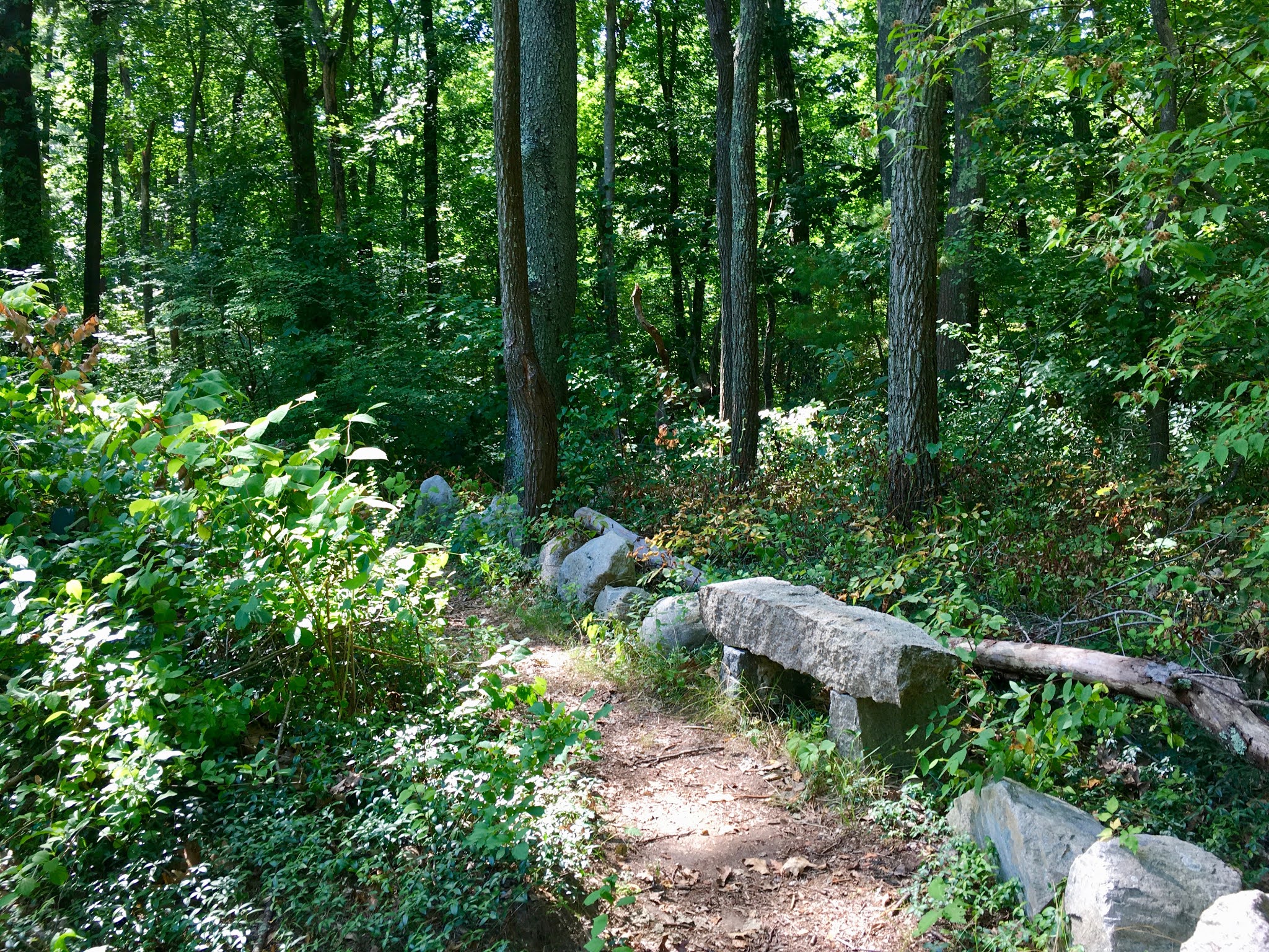


Indian Crossway

If you’ve visited the Burrage Pond Wildilfe Management Area in Hanson, you already know this terrain. But the 1.1-mile Indian Crossway trail offers alternate access, as well as new vantage points. Usually when we talk about historic properties, we’re referring to places that date back to the Colonial era. But this goes back much farther. Extending along the highland between the Great Cedar Swamp and the Burrage Pond reservoirs, it was established by Native Americans as a travel route between the North and Taunton River watershed. The waters here drain through Stump Brook to Robbins Pond, a headwater to the Satucket River, and part of the Taunton River watershed. Limited parking on Crooker Place in Hanson. 

Visit: https://www.nsrwa.org/listing/indian-crossway-conservation-area/


Great Pond Trail

Great Pond provides Weymouth’s drinking water. This 1-mile trail network extends through a beech and pine forest and along the lakeshore, skirting wetlands and glacial erratic boulders, and offering spectacular water views. Great Pond is part of the Back River watershed. Its waters flow northeast to Whitman’s Pond and the Back River. You’ll find trailheads and parking at two locations on Thicket Street -- Gifford Playground and Negus Park. 

Visit: https://www.nsrwa.org/listing/great-pond-trail/


Crosbie Family Preserve

Scituate has been on a roll lately! Not only has the town opened hundreds of acres of conservation land to the public, it has furnished them with excellent trail maps and parking areas. You’re going to want to check these places out. The newest among several properties off Clapp Road in the West End is the 50-acre Crosbie Family Preserve, which opened this summer. You’ll find stone walls, agricultural fields, and several intersecting loops trails through the woods and wetlands abutting South Swamp. The swamp drains to three different streams -- Aaron Brook and Bound Brook, which flow to the Gulf River and Cohasset Harbor, and First Herring Brook, a major tributary to the North River. Limited on-site parking just east of 253 Clapp Road, Scituate.

Visit: https://www.nsrwa.org/listing/crosbie-family-preserve/


Masthead Drive Trail

If you’ve enjoyed the North River from the water, you may have noticed this trail and wondered how to find it. Because of its location at end of a quiet road, nearly adjacent to Route 3, it’s not really “on the way” to anywhere. But it is well-worth the trip! Follow Norwell’s Masthead Drive to the very end, and park in the cul de sac. Look for the trailhead just behind the storm drain grate. Follow the trail through the woods, up and down some moderate rolling hills, and across a small footbridge. After 0.4 mile, you’ll find yourself looking out over the North River. It’s a gorgeous spot, and if you continue a little farther to the left, you’ll find two additional vantage points. 

Visit: https://www.nsrwa.org/listing/masthead-drive-trail/


Harbor Walk

In terms of conservation acreage, Marshfield runs at the front of the pack of South Shore towns, with only Plymouth boasting more open space. For those who prefer strolling on paved trails, the newly-expanded Harbor Walk provides endless scenery without the challenges of a forest hike. Located directly on Green Harbor, this wide concrete 1-mile path connects several popular landmarks -- the town pier, two parks, and the Brant Rock Esplanade -- with views of the harbor, the estuary, and the Green Harbor River. For parking, look for the small lot across the street from Harbor Park.

Visit: https://www.nsrwa.org/listing/harbor-park-and-harbor-walk/


Berrybrook Fields

For a glimpse of Duxbury’s agricultural past, check out these rolling green fields on Winter Street. This tree-lined 40-acre property features a small drumlin hill at its center with some impossibly picturesque oaks standing tall at the top. For a pleasant walk, follow the cart path along the eastern edge of the property, and continue all the way around the perimeter. The land here drains to Bassett Brook, part of the Jones River Watershed. Limited roadside parking on Winter Street.

Visit: https://www.nsrwa.org/listing/berrybrook-fields/


Studley Pond

Within Rockland’s busy commercial center, there’s this 29-acre oasis of calm -- Studley Pond. Located directly behind the CVS on Market Street, this is a great spot to fish, to paddle, or even just to pause for a few deep breaths. Known first as Silver Lake, and then Reed’s Pond, through the years it has been home to a mill, a box factory, an ice company, and even a swimming pavilion. You’ll see vestiges of its past along the shoreline. French’s Stream, a tributary to the Indian Head River, flows through the pond. Limited on-site parking.

Visit: https://www.nsrwa.org/listing/studley-pond-reeds-pond/


by Kezia Bacon

January 2021


Kezia Bacon's articles appear courtesy of the North and South Rivers Watershed Association, a local non-profit organization devoted to protecting our waters. For membership information and a copy of their latest newsletter, contact NSRWA at (781) 659-8168 or visit www.nsrwa.org. You will also find 25+ years of Kezia’s Nature columns there. 


Monday, November 30, 2020

Nature Walks in Whitman: 4 Places to Explore


In this twelfth and final month of its “50 Places to Explore” contest, NSRWA features the town of Whitman. Settled in 1670 but not incorporated until 1875, Whitman is famous for being the place where Ruth Graves Wakefield invented the Toll House cookie. The inn was lost to fire in 1984, but the recipe may live forever. (Look for the historic marker on Route 18.) Whitman was also once a hub for the shoemaking industry, with 20 different shoe-related factories spread across town. 


Covering seven square miles, Whitman is among the smallest towns in the state. The Shumatuscacant River a tributary to the Satucket River, flows through the eastern side of town, and Meadow Brook, a tributary to the Matfield River, flows through the western side. All four of these streams ultimately drain to the Taunton River. There is also a small section of town, east of Route 58, that is part of the North River watershed. Whitman’s conservation land is primarily wetlands, and not accessible to the public, but there are still a few great places you can explore on foot.


Hobart Pond

If a short stroll is what you have in mind, don’t miss Hobart Pond. “The Boulevard,” a 1/3-mile paved trail, provides pedestrian access between Essex Street and South Avenue. Extending along the edge of the pond, the trail is surrounded by a small grassy park, with another, smaller pond on the other side. Bordered by a cemetery, as well as residential and industrial properties, this 25-acre property offers a small slice of nature within a busy town. It’s also an opportunity to contemplate the history of the area. Hobart Pond was created in 1693, when the Shumatuscacant River, which flows through it, was dammed to provide power for a sawmill. In later years, a gristmill and an iron foundry were established nearby. The foundry produced bells, munitions and cannons. Still later, there was a tack factory, an essential component of the shoe industry. The trail is wide and flat — easily accessible for strollers and wheelchairs. Limited parking outside the property gates both 93 Essex Street and at the end of Colebrook Boulevard.

Visit: https://www.nsrwa.org/listing/hobart-pond/


Whitman Town Park

A landscaped municipal park might not be your first thought when considering a nature walk, but give this spot a chance when you’re seeking a quick breath of fresh air. This 14-acre historic property in the town center dates back to 1880. The land was a gift from Augustus Whitman, whose family gave the town its name. The Olmsted Brothers (sons of Frederick Law Olmsted), were hired to design both the c. 1900 park and its 1931 upgrade. Some of the original design elements remain, while others have been replaced by modern features, including athletic fields and a playground. The park was listed on the National Register of Historic Places in 2004. A broad gravel walking path extends for 0.45 miles around the perimeter, with a handful of similar internal trails. Extend your walk by also visiting Hobart Pond, just a couple blocks to the northeast on Essex Street. The park is located at 141 Whitman Ave., with ample parking on the streets that border it. 

Visit: https://www.nsrwa.org/listing/whitman-town-park/


Donald Flaherty Trail

Even though this 0.7-mile “out & back” is well-marked with a large wooden sign, it can be easy to miss. The trailhead is a little overgrown, but it opens up into a cart path that runs along an embankment with wetlands on either side. The trail continues through the woods, with a few short spurs, but ends abruptly at a large fallen tree. The wetlands and streams within this property drain to Meadow Brook, a tributary to the Matfield River. Look for great blue herons in the marshy areas. Roadside parking near 58 Auburn Street. 

Visit: https://www.nsrwa.org/listing/donald-flaherty-trail/


Whitman Hanson Regional High School

This 70-acre school property offers a loose network of roads, paved pathways, and trails through meadow and forest. I recommend this approx. 1-mile loop. Park at the tennis courts, and then backtrack to the granite “Whitman Hanson High School” marker on the entrance road. Continue up the hill and after about a tenth of a mile, look for a trail to the right. It follows a utility easement for about 1/3 mile before arcing back to a parking area. From there, look for a narrow trail in the far left corner. A footbridge leads over a culvert and continues through a wooded area. Go left at the fork, and you will soon cross another, wider, footbridge. Continue along the edge of the woods, all the way around the back of the school. As you emerge at the other side, look to the right for a wide paved trail, with curved lampposts. This “promenade” continues downhill past the football field and track, and ends at an intersection where you’ll see the tennis courts just ahead of you, completing your loop. The streams here drain to Poor Meadow Brook and the Shumatuscacant River. Located at 600 Franklin Street, with ample on-site parking during non-school hours. 

Visit: https://www.nsrwa.org/listing/whitman-hanson-regional-high-school/


by Kezia Bacon

December 2020


Kezia Bacon's articles appear courtesy of the North and South Rivers Watershed Association, a local non-profit organization devoted to protecting our waters. For membership information and a copy of their latest newsletter, contact NSRWA at (781) 659-8168 or visit www.nsrwa.org. You will also find 20+ years of Kezia’s Nature columns there. For more information about the 50 Places to Explore Contest,” visit https://www.nsrwa.org/get-outdoors/enter-the-nsrwa-50-places-to-explore-contest/  


Wednesday, October 28, 2020

Nature Walks in Abington: 7 Great Places to Explore


This month NSRWA features the town of Abington in its “50 Places to Explore” contest. Abington lies in the watershed of three river systems. French’s Stream, in the northeast quadrant, flows to the North River. Beaver Brook, in the westernmost part of town, flows to the Matfield River. But most of Abington centers on the Shumatuscacant River, which flows to the Satucket River. Parks and other public lands provide walking trails and diverse views of the river, whose name has been interpreted to mean both “spring meadow” and “beaver river.” I was pleased to make its acquaintance!


Abington is home to a number of conservation properties, however many of them are maintained as wildlife habitat, without public trails. While exploring the town, I was pleased to stumble upon the relatively new Griffin Dairy Farm, with its pleasant loop trail suitable for all abilities. Island Grove Park and the Ames Nowell State Park may be better known, but be sure to check out the trail at Beaver Brook Playground. It might be the best-kept secret in town!


Thompson Pond Trail

This trail system is located on the former South Weymouth Naval Air Station. It extends for nearly two miles through meadow and forest, offering views of French’s Stream and -- of course -- Thompson Pond. Heading north from the trailhead on Spruce Street, you’ll enter a vast open field. It’s easy to imagine the runways that existed here in decades past. Options are to follow a gravel road or choose a narrower route through the grass. After a sharp left turn, the trail crosses the West Branch of French’s Stream, and continues past the manmade Thompson Pond, which was created to help restore the natural wetlands that once existed on this site. Most of the trail is flat, but there are sections near the pond with a relatively steep slope. Designated parking area on Spruce Street.

Visit: https://www.nsrwa.org/listing/thompson-pond-trail/


Griffin Dairy Farm

Renovated in 2017, this 64-acre town-owned property offers a glimpse of Abington’s agricultural past with a modern twist. From 1925-1965, Lawrence & Annie Griffin operated a dairy farm here, producing bottled milk, corn, and hay. In later years, it was leased by the HP Hood Company. Now it’s the location of the Abington Community Garden, as well as a weekly summer farmers market. The parcel also features an athletic field and a picnic area. At the center is a flat, half-mile gravel loop trail, surrounded on all sides by meadow, with the occasional wetland. Spur trails lead to parking areas on Plymouth Street and Pattison Street. Extend your walk by turning right on Pattison, then left on Charles, to access the Rockland Rail Trail. An intermittent stream bisects the property, with footbridges providing trail crossings. The waterways here drain to the Shumatuscacant River.

Visit: https://www.nsrwa.org/listing/griffin-dairy-farm/


Rockland Rail Trail

Although it is named for Rockland, this 3-mile paved trail extends into Hanover and Abington. There are numerous access points -- including the Rockland Police Station, the Rockland Senior Center, and Rockland High School. You can also pick up the trail at its outermost point, on Circuit Street in Hanover, or at its closest proximity to MBTA’s Commuter Rail, on Monroe Street in Abington. Because it is fully paved, it can be used not only by hikers and cyclists, but also by people who use walkers, wheelchairs, and baby strollers. The Hanover Branch Railroad once extended from Hanover Four Corners, through South and West Hanover, across Rockland, to North Abington, where it connected with the Old Colony Railroad to Plymouth. It officially opened for service in 1868, and continued to operate into the 20th century. Today’s Rail Trail crosses over French’s Stream, which is one of the sources of the North River. It flows through Weymouth and Rockland into Hanover, where it joins the Drinkwater River, eventually becoming the Indian Head River. 

Visit: https://www.nsrwa.org/listing/rockland-rail-trail-hanover-branch-rail-trail/


Island Grove Park

The “Crown Jewel” of Abington’s public parks, this historic 53-acre property is set on a large pond, which is actually a dammed section of the Shumatuscacant River. The adjacent forest features about a mile of walking trails, plus swimming, fishing, ice skating, and a playground. A dramatic Memorial Arch and Bridge, constructed in 1912, stands in memory of the town’s Civil War soldiers and sailors. Additional memorials within the park commemorate the annual (1846-1865) “August First” meeting of William Lloyd Garrison and his fellow abolitionists. This is a beautiful place to walk, in any season. The trees and the water provide a fascinating and ever-changing backdrop. There is ample on-site parking at 123 Park Street.

Visit: https://www.nsrwa.org/listing/island-grove-park/


Butterfly Park

Blink and you might miss this tiny 0.2-acre parcel, just upstream of Island Grove Park. Located directly on the Shumatuscacant River, this enchanting little spot invites visitors to observe the natural world. The plantings, maintained by the Abington Garden Club, are designed to attract butterflies. There aren’t any trails, but this very small park is a lovely setting for a quick breath of fresh air, or to contemplate nature. Limited parking at 199 Central Street. 

Visit: https://www.nsrwa.org/listing/butterfly-park/


Beaver Brook Playground and Mt. Vernon Cemetery

At first glance, this 12.5-acre property at the end of Ralph Hamlin Jr. Blvd might appear as simply a playground within a public school complex. But look closely and you’ll find something wonderful. To the right of the playground, there is a small fishing pond. Cross the bridge beside the pond and you’ll find several trails. Take the one to the right. It continues through the woods, along the banks of the Shumatuscacant River. The trail may be relatively short (0.3 mile), but it proceeds over rolling hills, alongside a secluded section of river, … plus you can extend your walk through the historic Mount Vernon Cemetery. It’s actually quite lovely! A quick note about the name: the land that is now Abington was once known as Manamooskeagin (“land of many beavers”). Even though the facilities on this property are named for Beaver Brook, it’s actually the Shumatuscacant River that flows through. Beaver Brook itself is located elsewhere in town! The Shumatuscacant is part of the Satucket River watershed; Beaver Brook is part of the Matfield River watershed. They both eventually flow into the Taunton River.

Visit: https://www.nsrwa.org/listing/beaver-brook-playground/


Ames Nowell State Park

Abington’s largest open space parcel, this 700-acre state park spreads out around Cleveland Pond. There are ten miles of trails -- some wide, some narrow -- with options for short walks and longer adventures. Many are marked with numbered blue blazes, but quite a few are not. Bring a map! While mills existed on this site as early as the 1700s, the pond was created in 1920, when Edwin Holmes dammed Beaver Brook. He maintained the land as a bird sanctuary and hunting spot, but lost it during the Depression. The park’s namesake, Ames Nowell, the grandson of Massachusetts Governor Oliver Ames, purchased it next. Beaver Brook enters the property from the north and flows through the pond, continuing south through Abington and Bridgewater, eventually merging with Spring Brook and emptying into the Matfield River. Ample on-site parking on Linwood Street.

Visit: https://www.nsrwa.org/listing/ames-nowell-state-park/


by Kezia Bacon

November 2020


Kezia Bacon's articles appear courtesy of the North and South Rivers Watershed Association, a local non-profit organization devoted to protecting our waters. For membership information and a copy of their latest newsletter, contact NSRWA at (781) 659-8168 or visit www.nsrwa.org. You will also find 20+ years of Kezia’s Nature columns there. For more information about the 50 Places to Explore Contest,” visit https://www.nsrwa.org/get-outdoors/enter-the-nsrwa-50-places-to-explore-contest/  


Monday, October 5, 2020

Nature Walks in Hanson: 9 Worthwhile Places to Explore


This month NSRWA features the town of Hanson in its “50 Places to Explore” contest. When I began researching this article, I had visited only half of the properties on this list. Two of them I hadn’t even heard of! For the past few decades, Hanson has been quietly acquiring and improving open space parcels. As the years pass, it will it continue to increase both the visibility and the accessibility of these spots.


Rocky Run was the first conservation area I ever visited in Hanson, many years ago, and it quickly became one of my favorites throughout all of the South Shore. Fern Hill Cemetery was a pleasant recent discovery. It offers not only a view of, but access to, Wampatuck Pond! I might have entirely missed the best part of Smith-Nawazelski Conservation Area, if not for a journey down an internet rabbit hole that unearthed photos of the property’s boardwalk over Poor Meadow Brook. 


Some of Hanson’s open spaces are either still in the planning stages, or intended to be kept wild. The Carolyn Ready Conservation Area on Holmes Street is well-marked but does not appear to have trails. The Hunt Preserve on Winter Street has been reserved solely for wildlife habitat. Various parcels in the Poor Meadow Brook watershed are awaiting funding and/or a higher position on the priority list. It’s exciting to see the pieces fall into place. In the meantime, the list below provides 9 places you can visit today, most of them are large enough for an hourlong walk.


Smith-Nawazelski Conservation Area

From its entrance on Elm Street, this 111-acre property may appear lackluster. But follow the trail along the power easement all the way to the rear of the parcel, and you’re in for a pleasant surprise. First head into the woods; a short distance farther, turn right toward the freshwater marsh. Within a few steps, you’ll be on an extended (if rustic) boardwalk that traverses Poor Meadow Brook and its wetlands. It is a beautiful spot! Additional trails snake through the woods and alongside farmland. There are at least 2 miles to walk here — mostly wide cart paths but also sometimes narrow footpaths. Limited on-site parking at 482 Elm Street.

https://www.nsrwa.org/listing/smith-nawazelski-conservation-area/


Burrage Pond Wildlife Management Area

You could spend all day touring the trails of this 2000+ acre property, which is managed by the state as fisheries and wildlife habitat. Want to hike with a friend and have an extended conversation? This is your spot. There are 10 miles of walking trails, around ponds, marsh, swamps and retired cranberry bogs. Birders love this place, in part because of the wood ducks that breed here. Local history buffs might enjoy knowing that it was once logged for cedar, and later for peat, before becoming a large cranberry enterprise. Like Smith-Nawazelski, it is part of the Satucket River watershed, with Stump Brook providing an outlet. Ample parking at 382 Pleasant Street. Additional limited parking at 483 Elm Street.

https://www.nsrwa.org/listing/burrage-pond-wildlife-management-area/


Poor Meadow Brook Conservation Area

At present, walking access to this 115-acre property is limited to a very short gravel pathway along West Washington Street, and some narrow footpaths into the woods. But that’s likely to change in the future. But if you wish to explore by canoe or kayak, there’s a lot more to see. The gravel path leads directly to the Shumatuscacant River, where you can launch a small boat and set off downstream, Downstream is the confluence of the river and Poor Meadow Brook, and also (as reported) evidence of beaver activity. This too is part of the Satucket River watershed. Limited on-site parking at 891 West Washington Street (Route 14).

https://www.nsrwa.org/listing/poor-meadow-brook-conservation-area/


Fern Hill Cemetery & Wampatuck Pond

Another spot that offers opportunities for both walking and paddling is the historic Fern Hill Cemetery. Situated on a hill directly adjacent to Wampatuck Pond, this beautiful 6.6-acre property dates back to 1748. The public is welcome to stroll the rolling gravel roads that extend along the perimeter and among the rows of headstones -- some old, some new. A staircase at the back leads down to the shore, where there is water access for canoes, kayaks and fishing. Wampatuck Pond was created in 1695 by the damming of Wampatuck Brook. It lies within the Indian Head River watershed. Follow the paved road from the entrance on High Street to the rear of the cemetery, where you’ll find small parking area overlooking the pond.

https://www.nsrwa.org/listing/fern-hill-cemetery/


The Last Meadows

For a rare glimpse of Hanson’s agricultural past, check out this still-evolving 56-acre property. For centuries it was farmland. When the Plymouth County Hospital purchased it in 1920, much of the rural character was preserved. Some outbuildings remain, but the large facility that once stood here was demolished in 2017. Now owned by the town, the land is maintained for open space and wildlife habitat. Thanks to a 2020 MassTrails grant, a new trail leads through woods to a large open meadow. Wampatuck Pond is nearby, and there are plans to extend the trail to its shores. There is also a shorter forest trail, along a ridge, closer to the entrance. The lands here lie within the Indian Head River watershed. Ample parking at 228 High Street. Facing away from the street, the trail begins on the paved road to the right of the water tower.

https://www.nsrwa.org/listing/the-last-meadows/


Veterans Memorial Town Forest - Hanson

Working our way around Wampatuck Pond, we now arrive at the 37-acre Town Forest, a quiet expanse of woods and wetlands with some lovely water views. Overcrowded trees are selectively harvested here, to preserve the long-term health of the forest. There is a network of about 1 mile of well-trodden intersecting paths. Parking and trail access at the athletic fields on Route 58, and at the cul de sac at the end of Indian Trail. Look for the informational kiosk across the street from the Indian Head School. 

https://www.nsrwa.org/listing/veterans-memorial-town-forest-hanson/


Alton J. Smith Reserve 

A short way down Route 58 is another pond, the Indian Head. Right next door is the Alton J. Smith Reserve, a 103-acre retired cranberry bog surrounded by walking trails and wetlands. The Natural Resource Conservation Service is currently funding a restoration program here, to convert the streams and bog back to their natural state. A network of wide, flat roads provide ample space for walking and numerous opportunities for spotting wildlife. Parking and access from the Marcus L. Urann Fisherman’s Landing, off Route 58, and also behind the stone gatehouse on Camp Kiwanee Road. Additional spur trails through the woods lead to Camp Kiwanee and the J. J. Shepherd Town Forest in Pembroke. The headwaters of Indian Head Brook are located on this property. Indian Head Brook flows north from Indian Head Pond, through Wampatuck Pond and Little Cedar Swamp, into the Indian Head/Drinkwater River, which then flows into the North River and out to sea.

https://www.nsrwa.org/listing/alton-j-smith-reserve/


Rocky Run Conservation Area

Small but beautiful, this 13-acre property is one of the most intriguing spots on the South Shore -- a low valley of shady forest on the banks of the Indian Head River and Rocky Run Brook. Narrow footpaths extend up and down ridges to the water’s edge. Wider cart paths explore the property’s interior. The remains of a large stone/earthen dam reveal the area’s industrial past. Together with the Tucker Preserve, the Indian Head River Trails, and Luddam’s Ford in both Pembroke and Hanover, Rocky Run is part of a network of trails that leads up one side and down the other side of the river. The 4-mile hike is steep at times, and perhaps not the easiest to follow, but it is a fascinating place to explore. Limited parking on State Street, next to the bridge.

Https://www.nsrwa.org/listing/rocky-run-conservation-area/


Webster-Billings Conservation Area

This 62-acre forest was acquired by the town in 1973. A well-established network of woodland paths creates a peaceful haven. Surrounded by residential areas off East Washington, State and Brook Streets, this is a lovely spot to explore. Look for old stone walls, especially at the boundaries. The primary trail is marked with red paint and (sometimes) pink surveyor’s tape. Numerous spur trails lead off into neighborhoods, and to Indian Head Brook, a tributary to the Indian Head River. Limited roadside parking at the ends of Puritan Avenue, Old Pine Drive and Williams Way.

 https://www.nsrwa.org/listing/webster-billings-conservation-area/


by Kezia Bacon

October 2020


Kezia Bacon's articles appear courtesy of the North and South Rivers Watershed Association, a local non-profit organization devoted to protecting our waters. For membership information and a copy of their latest newsletter, contact NSRWA at (781) 659-8168 or visit www.nsrwa.org. You will also find 20+ years of Kezia’s Nature columns there. For more information about the 50 Places to Explore Contest,” visit https://www.nsrwa.org/get-outdoors/enter-the-nsrwa-50-places-to-explore-contest/  


Wednesday, August 26, 2020

Nature Walks in Rockland: 6 Notable Places to Explore


This month NSRWA features the town of Rockland in its “50 Places to Explore” contest. Rockland might not immediately come to mind when you’re searching for a place to walk in nature. But if you visit the properties listed below, you may be pleasantly surprised at what they have to offer. Especially along its borders, Rockland is home to some remarkably beautiful and interesting places!


 Rockland Town Forest

A natural oasis in the midst of a bustling suburban town, this small, well-maintained 43-acre woodland features a trail network with up-close views of French’s Stream, a headwater tributary to the Indian Head/North River system. It exists largely because of George Anderson, the chairman of the Rockland Town Forest Committee, who has been very active in developing, maintaining and improving the trails, and otherwise keeping the property in top shape. Watch for curious stacks of stones, the occasional windchime . . . even a cleverly-placed gnome, all of which add an air of whimsy. Originally established in 1984 with just under 20 acres, the Rockland Town Forest has now doubled in size. Boardwalks and stream crossings make it especially captivating for younger children. Enter from North Avenue for limited on-site parking. Additional parking on Spruce Street, at Thompson Pond/Twin Pond Trail Network (diagonally across the road). https://www.nsrwa.org/listing/george-anderson-rockland-town-forest/


Rockland Rail Trail

This 3-mile, paved, easy-to-follow trail for walking and bicycling extends from the Hanover/Rockland town line to North Abington. There are several road crossings, each marked with a yellow metal gate that permits individuals to pass, but not cars. Proceed with caution through all intersections. Some are relatively quiet, but others involve major roadways such as Routes 139 and 123. At Union Street, there is a small section featuring the original rails from the railroad bed, as well as an informational kiosk. Heading west, the trail continues through residential areas and eventually passes by Rockland’s Senior Center, golf course, and high school, crossing French’s Stream as it approaches its terminus in Abington. Park at the Rockland Police Department, 500 Market Street. Additional access from the cul de sac at the end of Circuit Street in West Hanover (follow a short trail through the woods), at the Hanover Senior Center, and at the North Abington MBTA station. https://www.nsrwa.org/listing/rockland-rail-trail-hanover-branch-rail-trail/


Summer Street Conservation Lands

This 14-acre forest, primarily pine and oak, is not currently accessible from Rockland, however there are two access points in Hanover’s Forge Pond Park. The trail through the Summer Street Conservation Lands provides a vital woodland connection between the French’s Stream Trail to the east and the Old Rockland Fireworks Loop to the west. (The lands here, like much of Rockland, are part of the French’s Stream watershed.) 

Follow the French’s Stream Trail from Parking Lot E at Forge Pond Park to the French’s Stream Bridge. Look for another trail just to the left of the bridge entrance, heading into a grassy power easement. This unnamed trail, marked with red Hanover Conservation blazes, continues through the Summer Street Conservation Lands for about a mile. After a second power easement, the trail connects with the Old Rockland Fireworks Loop, as well as the Clark Bog Trail. For parking, Lots C, D and E at Forge Pond Park in Hanover (245 King Street) provide the best access. https://www.nsrwa.org/listing/summer-street-conservation-lands/


Old Rockland Fireworks Loop 

Catch a glimpse of the area’s industrial past on this wide, partially paved, 1-mile forest trail. Concrete structures, some covered completely with graffiti, present a stark contrast to this otherwise wooded landscape. Small brooks -- part of the French's Stream watershed -- run along both sides of the trail, and occasionally you’ll see a concrete pipe or culvert as well. This property is easily confused with the Hanover Fireworks trail system, across King Street from Forge Pond Park. The Old Rockland Fireworks Loop remains open, while the Hanover Fireworks property is closed due to unexploded ordinance within its boundaries that is in the process of being detonated and/or removed. (Please respect the “Trail Closed” signs.) The primary access point, with ample parking, is at Forge Pond Park in Hanover. Download a trail map and follow the Clark Bog Trail from Lot C. Additional access from Satucket Road in Rockland. Look for the two boulders on the left side of the road, in the section where there are no houses. Park on the street, and bear right when the trail forks. https://www.nsrwa.org/listing/old-rockland-fireworks-loop-trail/


Hingham Street Reservoir

A picturesque public water supply surrounded by a 1.5-mile trail. The name might be misleading, but the scenery is beautiful! The reservoir -- which is located on Hingham Street in Rockland -- supplies water to the towns of Abington and Rockland. Public access, however, is from Deerfield Lane in Hanover. If you’re driving in from Whiting Street, look to the right, just before Deerfield makes a sharp curve to the left. Park along the side of the road. The trail -- which is mostly level and clear -- cuts quickly through a woodland and out to the reservoir, where it extends around the perimeter. It is bordered by young pine, birch and maple trees, and an abundance of sweet pepper bush. There are occasional boulders and outcroppings of rock, which generally offer the best views of the water. Ben Mann Brook, which flows through the property, flows into Cushing Brook, a tributary to the Indian Head/North River system. 

https://www.nsrwa.org/listing/hingham-street-reservoir/


Twin Ponds Trail

After the South Weymouth Naval Air Station officially closed in 1997, some of the land on which it stood was opened to the public. This included the Twin Ponds property, a 2-mile trail system through woods and wetlands. Prior to the formation of the Naval Air Station (1942), it was a hog farm. From the parking area on Spruce Street, at the Abington/Rockland town line, the blue-blazed trail heads north through a meadow and into the woods. After crossing over the East Branch of French’s Stream, it continues past two ponds (the Twin Ponds) and onward, with occasional wooden walkways. Sometimes the trail -- which includes two loops -- is wide and flat; other times it’s narrow. There are numerous rocky outcroppings along the way, plus several old stone walls. It may be helpful to carry a map. Limited on-site parking on Spruce Street in Rockland. https://www.nsrwa.org/listing/twin-ponds-trail/


by Kezia Bacon

September 2020


Kezia Bacon's articles appear courtesy of the North and South Rivers Watershed Association, a local non-profit organization devoted to protecting our waters. For membership information and a copy of their latest newsletter, contact NSRWA at (781) 659-8168 or visit www.nsrwa.org. You will also find 20+ years of Kezia’s Nature columns there. For more information about the 50 Places to Explore Contest,” visit https://www.nsrwa.org/get-outdoors/enter-the-nsrwa-50-places-to-explore-contest/