Wednesday, August 26, 2020

Nature Walks in Rockland: 6 Notable Places to Explore


This month NSRWA features the town of Rockland in its “50 Places to Explore” contest. Rockland might not immediately come to mind when you’re searching for a place to walk in nature. But if you visit the properties listed below, you may be pleasantly surprised at what they have to offer. Especially along its borders, Rockland is home to some remarkably beautiful and interesting places!


 Rockland Town Forest

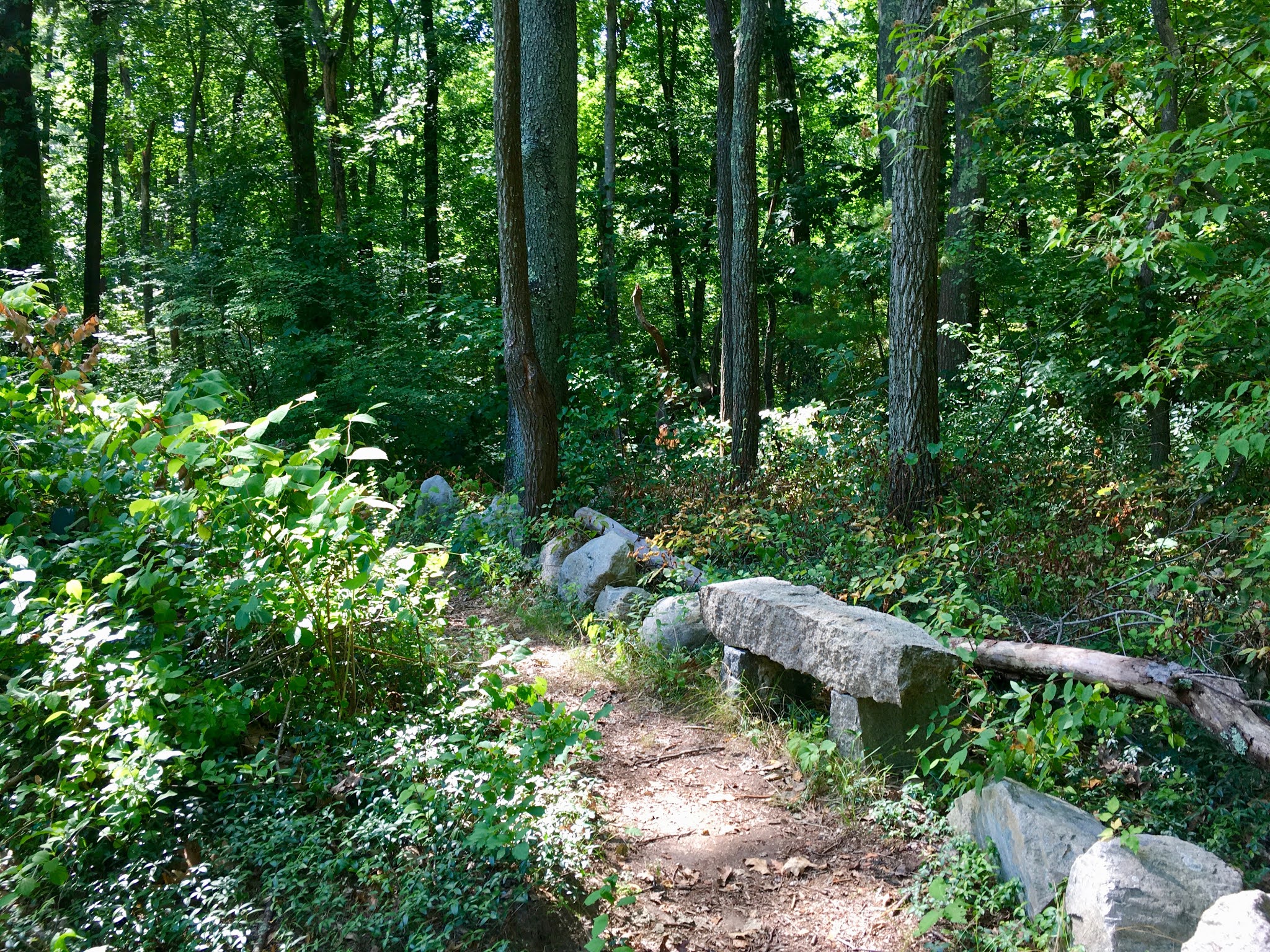
A natural oasis in the midst of a bustling suburban town, this small, well-maintained 43-acre woodland features a trail network with up-close views of French’s Stream, a headwater tributary to the Indian Head/North River system. It exists largely because of George Anderson, the chairman of the Rockland Town Forest Committee, who has been very active in developing, maintaining and improving the trails, and otherwise keeping the property in top shape. Watch for curious stacks of stones, the occasional windchime . . . even a cleverly-placed gnome, all of which add an air of whimsy. Originally established in 1984 with just under 20 acres, the Rockland Town Forest has now doubled in size. Boardwalks and stream crossings make it especially captivating for younger children. Enter from North Avenue for limited on-site parking. Additional parking on Spruce Street, at Thompson Pond/Twin Pond Trail Network (diagonally across the road). https://www.nsrwa.org/listing/george-anderson-rockland-town-forest/


Rockland Rail Trail

This 3-mile, paved, easy-to-follow trail for walking and bicycling extends from the Hanover/Rockland town line to North Abington. There are several road crossings, each marked with a yellow metal gate that permits individuals to pass, but not cars. Proceed with caution through all intersections. Some are relatively quiet, but others involve major roadways such as Routes 139 and 123. At Union Street, there is a small section featuring the original rails from the railroad bed, as well as an informational kiosk. Heading west, the trail continues through residential areas and eventually passes by Rockland’s Senior Center, golf course, and high school, crossing French’s Stream as it approaches its terminus in Abington. Park at the Rockland Police Department, 500 Market Street. Additional access from the cul de sac at the end of Circuit Street in West Hanover (follow a short trail through the woods), at the Hanover Senior Center, and at the North Abington MBTA station. https://www.nsrwa.org/listing/rockland-rail-trail-hanover-branch-rail-trail/


Summer Street Conservation Lands

This 14-acre forest, primarily pine and oak, is not currently accessible from Rockland, however there are two access points in Hanover’s Forge Pond Park. The trail through the Summer Street Conservation Lands provides a vital woodland connection between the French’s Stream Trail to the east and the Old Rockland Fireworks Loop to the west. (The lands here, like much of Rockland, are part of the French’s Stream watershed.) 

Follow the French’s Stream Trail from Parking Lot E at Forge Pond Park to the French’s Stream Bridge. Look for another trail just to the left of the bridge entrance, heading into a grassy power easement. This unnamed trail, marked with red Hanover Conservation blazes, continues through the Summer Street Conservation Lands for about a mile. After a second power easement, the trail connects with the Old Rockland Fireworks Loop, as well as the Clark Bog Trail. For parking, Lots C, D and E at Forge Pond Park in Hanover (245 King Street) provide the best access. https://www.nsrwa.org/listing/summer-street-conservation-lands/


Old Rockland Fireworks Loop 

Catch a glimpse of the area’s industrial past on this wide, partially paved, 1-mile forest trail. Concrete structures, some covered completely with graffiti, present a stark contrast to this otherwise wooded landscape. Small brooks -- part of the French's Stream watershed -- run along both sides of the trail, and occasionally you’ll see a concrete pipe or culvert as well. This property is easily confused with the Hanover Fireworks trail system, across King Street from Forge Pond Park. The Old Rockland Fireworks Loop remains open, while the Hanover Fireworks property is closed due to unexploded ordinance within its boundaries that is in the process of being detonated and/or removed. (Please respect the “Trail Closed” signs.) The primary access point, with ample parking, is at Forge Pond Park in Hanover. Download a trail map and follow the Clark Bog Trail from Lot C. Additional access from Satucket Road in Rockland. Look for the two boulders on the left side of the road, in the section where there are no houses. Park on the street, and bear right when the trail forks. https://www.nsrwa.org/listing/old-rockland-fireworks-loop-trail/


Hingham Street Reservoir

A picturesque public water supply surrounded by a 1.5-mile trail. The name might be misleading, but the scenery is beautiful! The reservoir -- which is located on Hingham Street in Rockland -- supplies water to the towns of Abington and Rockland. Public access, however, is from Deerfield Lane in Hanover. If you’re driving in from Whiting Street, look to the right, just before Deerfield makes a sharp curve to the left. Park along the side of the road. The trail -- which is mostly level and clear -- cuts quickly through a woodland and out to the reservoir, where it extends around the perimeter. It is bordered by young pine, birch and maple trees, and an abundance of sweet pepper bush. There are occasional boulders and outcroppings of rock, which generally offer the best views of the water. Ben Mann Brook, which flows through the property, flows into Cushing Brook, a tributary to the Indian Head/North River system. 

https://www.nsrwa.org/listing/hingham-street-reservoir/


Twin Ponds Trail

After the South Weymouth Naval Air Station officially closed in 1997, some of the land on which it stood was opened to the public. This included the Twin Ponds property, a 2-mile trail system through woods and wetlands. Prior to the formation of the Naval Air Station (1942), it was a hog farm. From the parking area on Spruce Street, at the Abington/Rockland town line, the blue-blazed trail heads north through a meadow and into the woods. After crossing over the East Branch of French’s Stream, it continues past two ponds (the Twin Ponds) and onward, with occasional wooden walkways. Sometimes the trail -- which includes two loops -- is wide and flat; other times it’s narrow. There are numerous rocky outcroppings along the way, plus several old stone walls. It may be helpful to carry a map. Limited on-site parking on Spruce Street in Rockland. https://www.nsrwa.org/listing/twin-ponds-trail/


by Kezia Bacon

September 2020


Kezia Bacon's articles appear courtesy of the North and South Rivers Watershed Association, a local non-profit organization devoted to protecting our waters. For membership information and a copy of their latest newsletter, contact NSRWA at (781) 659-8168 or visit www.nsrwa.org. You will also find 20+ years of Kezia’s Nature columns there. For more information about the 50 Places to Explore Contest,” visit https://www.nsrwa.org/get-outdoors/enter-the-nsrwa-50-places-to-explore-contest/  


Tuesday, July 28, 2020

Nature Walks in Hanover: 13 Places to Explore

A view from the Forge Pond Trail, at Forge Pond Park in Hanover.
This month NSRWA features the town of Hanover in its “50 Places to Explore” contest. When I began researching Hanover’s conservation lands last year, I knew only a few of the properties on this list. The discovery process has been a delight! 

Many of us know only of Hanover’s commercial areas -- the mall, and the very busy stretches of Routes 53 and 139. Meanwhile, on the other side of town, there’s a fascinating system of waterways -- the Drinkwater, Indian Head and North Rivers, as well as their numerous tributaries. Who knew Hanover had so many brooks and streams? So many forests and swamps? 

In general, Hanover’s trails are well-marked and well-tended. My favorite “old friend” is the former railroad bed that runs along the Indian Head River. As for new discoveries, I’ve thoroughly enjoyed getting to know the trails at Melzar Hatch, Colby-Phillips, Forge Pond Park, and Chapman’s Landing. The list below -- pretty much all town-owned conservation lands -- provides you with plenty of destinations to add to your To Do list.


 Colby-Phillips Trails
The 147-acre Colby-Phillips property offers an impressive start, with a boardwalk that leads across a forested wetland and into the woods. From there, you have access to three miles of looping trails. Other features include a wildlife observation platform, a bridge over Cushing Brook, and the historic West Hanover Cemetery. Park at the Hanover Middle School and cross Whiting Street to find the main trailhead. https://www.nsrwa.org/listing/colby-phillips-trails/


 Melzar Hatch Preserve 
Right behind Hanover Middle School is the trailhead for the 47-acre Melzar Hatch Preserve. Half of this loop trail is set in the woods, with numerous footbridges crossing Longwater Brook and the Drinkwater River. The other half traces the grassy perimeter of school properties and athletic fields. Park at Hanover Middle School, 45 Whiting Street. https://www.nsrwa.org/listing/melzar-hatch-preserve/


 Forge Pond Park
I was surprised and very pleased to discover that -- beyond the grassy fields of this 40-acre athletic complex -- there are not one, not three, but five different trails to explore! My favorite is the French’s Stream Trail, where a wooden bridge offers a clear view of the confluence of French’s Stream and the Drinkwater River. Other walking paths include the Forge Pond Trail, along the edge of the pond, a woodland trail through Rockland’s Summer Street Conservation Area, the Old Rockland Fireworks Trail, through a former industrial area, and the Clark Bog Trail, which traverses the woods and wetlands of a retired cranberry bog. You’ll find ample parking at 245 King Street. https://www.nsrwa.org/listing/forge-pond-park/ For more information, check out my much more detailed article from last year: (https://www.nsrwa.org/the-hidden-gems-of-hanovers-forge-pond-park/


 Pine Island Trails
While the three previous properties are likely to attract a devoted following, some of Hanover’s other properties aren’t quite as captivating at first glance. This spot, set between a residential area and a power easement, is a great place to visit when you’re seeking a quick walk in the woods and some solitude. The 1-mile trail network extends through meadows and forest, and is bordered by Pine Island Swamp. Limited roadside parking at two different Old Farm Road trailheads. https://www.nsrwa.org/listing/pine-island-trails/


Plain Street Trails 
As above, the 2 miles of trails at this Plain Street property may not be the most engaging, but they offer a peaceful setting and an opportunity to look closer at the natural world. Bordered by a power easement as well as several residential roads, these woods and wetlands are great spots for wildlife observation. Pedestrian access with roadside parking on Old Farm Road, Fair Acres Drive, Aspen Drive, Tucker Road, and Colonial Drive. https://www.nsrwa.org/listing/plain-street-trails/


Denham Pond 
Another smaller property, this spot isn’t the easiest to find. Blink and you will miss the access road at 106 Circuit Street. Park in the grassy area between the pond and the road. A 1.2-mile loop trail extends all the way around the pond, through woods and wetlands. https://www.nsrwa.org/listing/denham-pond-park/


 Nava-Stasiluk Conservation Area
Off Center Street, you’ll find a cluster of three interconnecting trail systems -- Nava-Stasiluk, Hanover Senior Center, and Tindale Bog. Park in the small lot at 526 Center Street, and continue through the woods. Various trails lead to Torrey Brook, the Hanover Senior Center, Myrtle Field, and a section of the former Hanover Branch Railroad. Across Center Street, continue on the railroad bed to Tindale Bog, where there is another small woodland trail network. https://www.nsrwa.org/listing/nava-stasiluk-conservation-area/


Folly Hill & Bog Iron Trails 
These 38 acres of conservation land, with 3.6 miles of trails and the occasional footbridge, are tucked in between residential, commercial, and Water Protection properties. Formerly cranberry bogs, they are now a quiet expanse of woods and wetlands. Iron Mine Brook flows through, on its way to the Indian Head River. Access and roadside parking via Willow Road, Beechtree Road, Broadway, and the Hanover Police Station. https://www.nsrwa.org/listing/folly-hill-and-bog-iron-trails/


Phillips Sanctuary & Firehouse Loop
This beautiful 55-acre woodland offers a glimpse of Hanover’s earlier days, when there were fewer houses and many more trees. A 1.6-mile network of loop and spur trails provides a pleasant walk through the forest, with numerous opportunities for wildlife observation. Access and parking at Alden Road and at the Fire Station Museum on Broadway. https://www.nsrwa.org/listing/phillips-sanctuary-and-firehouse-loop/


Shingle Mill Brook Trail
If you’re in the mood for exploring a new spot, check out this trail. It leads to a gorgeous grove of beech trees set on a drumlin hill, and then into the mixed woods and wetlands surrounding Shingle Mill Brook. Not all of the trails are well-marked, so be mindful. This is a relatively small conservation property -- about 10 acres. Look for the trailhead on Virginia Drive. https://www.nsrwa.org/listing/shingle-mill-brook-trail/


Hingham Street Reservoir 
The Hingham Street Reservoir wins the prize for the most confusingly-named property around. Also known as the Abington-Rockland Reservoir, because it provides water to those towns, it is located on Hingham Street in Rockland. However, you can access it much more easily from Deerfield Lane in Hanover. Look for the trailhead at the sharp curve in the road, about halfway down. Follow the trail through the woods and you’ll find yourself on a 1.5-mile loop trail that runs the perimeter of this picturesque public water supply. https://www.nsrwa.org/listing/hingham-street-reservoir/


Chapman’s Landing & Iron Mine Brook 
The end of Indian Head Drive in Hanover was already a great spot, because it’s the location of the Hanover Public Launch, an excellent river access point for canoes and kayaks. But wait -- there’s more! On the other side of the cul-de-sac, you’ll find trailheads for the Chapman’s Landing and Iron Mine Brook Trails. A combination of state and local agencies owns these 50 acres of conservation land. Along the 2 miles of intersecting trails, you’ll find several gorgeous views of the Indian Head River, two crossings of Iron Mine Brook, and a large and very curious pile of stones with historic origins. Ample parking at the end of Indian Head Drive. https://www.nsrwa.org/listing/chapmans-landing-and-iron-mine-brook-trails/


Indian Head River Trails/Luddam’s Ford Park 
One of my all-time favorites, this spot is rich with history and also quite pretty! The park is relatively small (22 acres), but the trail, which extends for two miles upriver to the Hanson town line, follows the route of the former Hanover Branch railroad. In some spots, the views are like nothing else you’ve seen on the South Shore. It’s well worth your time to visit! Limited on-site parking at 243 Elm Street. https://www.nsrwa.org/listing/indian-head-river-trails/

by Kezia Bacon
August 2020

Kezia Bacon's articles appear courtesy of the North and South Rivers Watershed Association, a local non-profit organization devoted to protecting our waters. For membership information and a copy of their latest newsletter, contact NSRWA at (781) 659-8168 or visit www.nsrwa.org. You will also find 20+ years of Kezia’s Nature columns there. For more information about the 50 Places to Explore Contest,” visit https://www.nsrwa.org/get-outdoors/enter-the-nsrwa-50-places-to-explore-contest/