Showing posts with label Indian Head River. Show all posts

Wednesday, March 20, 2019

Project Dale and Pembroke’s Tucker Preserve


Lately I’ve become fascinated with a certain stretch of the Indian Head River. From the bridge on Cross and State Streets, at the Hanover-Hanson town line, to Luddam’s Ford Park in Hanover and Pembroke, the river flows for two miles through a peaceful, secluded valley. On the Hanover side, a wide, mostly-flat woodland trail traces the route of the historic Hanover Branch railroad, passing behind private homes as it follows the course of the river. On the Hanson and Pembroke side, a network of cart paths and narrow trails provides access to both the forested upland and the water’s edge. It takes about two hours to walk the complete circuit.

Within this stretch lies an area once known as Project Dale. In Barry’s 1853 Historical Sketch of the Town of Hanover, it is described as, “very pleasant, . . .  surrounded by hills, clothed with evergreen, and deciduous trees.” A dale is a valley – usually a broad, open one. Today, this part of the Indian Head is no longer broad nor open, but it remains a valley . . . a geographic feature that’s relatively rare in our watershed. 

But what – you might ask -- is does the word “Project” signify? It’s hard to imagine, since now it’s so serene, but just 150 years ago this was a booming center of industry. “Project” likely refers to enterprise – specifically the tack factory that stood here. Between the tack factory, the railroad, the nearby anchor forge and additional factories, this was a busy place.

(from Briggs' History of Shipbuilding on North River)
Back in those days, the water level in the river was significantly higher and wider. Not for any natural reason – but because of dams. There was a dam at the tack factory, and when you walk along the water’s edge on the Hanson side of the river, you can easily discern where the water used to flow. 


There was – and still is – a dam at Luddam’s Ford too. While dams may fuel industries, they also prevent migratory fish from reaching their spawning grounds. These days, with the factories on our rivers long since gone, many communities are opting to remove obsolete dams and restore fish passage. 

Project Dale is a captivating spot. One of the best ways to access it is through the Tucker Preserve, a property owned by the Wildlands Trust. I recommend starting from the Pembroke side of Luddam’s Ford Park on West Elm Street, where you’ll find a large parking lot. Look upstream across the pondside meadow, and you’ll see a kiosk with a trail heading into the woods. 


For now, pay no attention to the colorful graffiti-covered ruins on the wooded side of the trail. We’ll get back to those later. Instead, keep your eyes on the river. Follow the path along the water’s edge. Soon a wooden bridge leads you across a brook, and then the trail begins a moderate incline. 


There is a wider, flatter option to the left, but the narrow trail to the right offers the best view. This is the Indian Head River, appearing more like a pond here because of the dam downstream. 


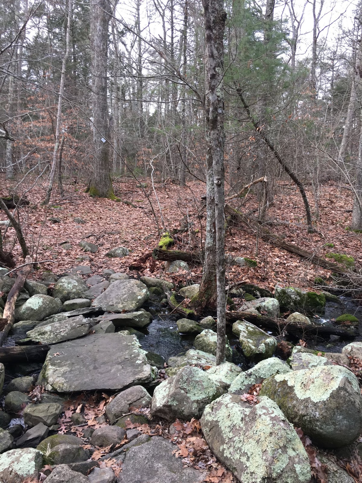
The trail continues through the woods to a second stream crossing, and this time you’ll have to make your way across flat rocks to reach the other side. Some days, it’s easy. Other days, when more water is flowing, the crossing requires precise footwork. 

 At this point you will have entered a hemlock grove. If you look toward the river, you’ll find that you’ve climbed to the top of a ridge. Very likely you’ll spy a building in the distance. Continue along the trail, deeper into the woods. As the trail veers closer to the edge of the ridge, look down again. The valley is much narrower here, and incredibly picturesque. You are now at Project Dale. The building across the river was once the Waterman Tack Factory. 


 Beginning in the 1700s, this site was home to a number of industries. The earliest was probably a carding mill, where wool fibers were prepared for spinning. Other incarnations included a fulling mill (to clean and thicken wool fiber), and later a grist mill. In 1830, a tack factory moved in. Several owners later, it became the domain of L. C. Waterman & Co. In 1860, with 12 machines in operation, it employed 8-10 people and produced to 50-60 tons of tacks per year. Waterman tacks were used primarily in shoes, but also in the furniture and upholstery trades, and for laying carpet. Historians indicate that many shoe repair shops, even in New York and Philadelphia, would only use Waterman tacks. The business continued to expand and thrive, and by 1875 it employed 25 people and produced 250 tons of tacks per year.

I love this spot for its beauty, but even more because of how it illustrates the passage of time. Looking down from the ridge, you can see scattered remains of a concrete dam along the water’s edge.Scanning the course of the river, you might imagine how the power of the water behind the dam was harnessed to fuel the factory. You can probably guess where the water went in, and where it went out. But now, 150 years later, where has it all gone?


In February 1886 there was an unusually heavy rain – what historians refer to as a “freshet.” The water rose at such speed, and to such height, that it severely damaged not only the factory but the adjacent train tracks. The railroad was repaired, but ceased operations in the 1930s. Subsequent storms in 1938 and 1954 did permanent damage to industries throughout the river valley. Since then, Project Dale has become a different world. It’s so quiet now – and so natural -- it’s hard to imagine it was ever any other way.


The trail continues a short distance from the factory overlook and soon reaches the Tucker Preserve’s western boundary. 


Turn back here, and retrace your route until you reach the brook you crossed on foot. This time, proceed to your right and follow a loop trail through the southern half of the 78-acre property. (I recommend carrying a map). This will eventually bring you back to the wooden bridge and Luddam’s Ford.

As you approach the end of the trail, you will once again notice brightly-graffiti’d ruins in the woods off to your right. 


These are remains of the E. H. Clapp Rubber Works, which stood on both sides of the river at the turn of the 20thcentury. Norwell native Eugene Clapp began his enterprise in Hanover in 1873, using water power to grind and process rubber. By 1879 he was using steam power, and soon expanded into multiple buildings on both the northern and southern banks. 


A decade later, according to Briggs’ History of Shipbuilding on North River, he was “doing two or three times as much work as any of his competitors, and (was) handling more than one half of this business in the United States.”

from Briggs' History of Shipbuilding on North River


Thanks to the Wildlands Trust, the Tucker Preserve has been open to the public since 1993. It’s a special place -- not only rich in history, but populated by unusual (for this region) vegetation and wildlife. It is open daily from dawn to dusk. 

by Kezia Bacon
March 2019

Kezia Bacon's articles appear courtesy of the North and South Rivers Watershed Association, a local non-profit organization devoted to protecting our waters. For membership information and a copy of their latest newsletter, contact NSRWA at (781) 659-8168 or visit www.nsrwa.org. To browse 20 years of nature columns, visit http://keziabaconbernstein.blogspot.com

Friday, May 2, 2014

Lost in the Woods

-->
A view of the Indian Head River from the Hanover side.
 We had been walking in the forest for more than an hour. We were still on a trail, but it did not seem to be headed in the right direction . . . or in any particular direction. A few times we’d had to retrace our steps: either the trail would end in a No Trespassing sign, or in someone’s back yard, or it would disappear entirely. We were lost in the woods.

Not that we were entirely lost! We had followed a very clear path up one side of the Indian Head River in Hanover. We had crossed the river at State Street in Hanson, and followed a trail back into the woods in Pembroke, with the intention of finding our way into the Wildlands Trusts’s Tucker Preserve, which wasn’t all that far downstream. But we never found it. So we sort-of knew where we were, but not really.

This was a familiar predicament. I’d walked the inviting, scenic trails along the Indian Head River before. At least once, I’d found my way back to the parking area on West Elm Street, via the 78-acre Tucker Preserve. But once or maybe twice before, I’d been similarly lost: on a trail, but not the right trail.

The landmarks were familiar – I’d been there before. But I couldn’t be sure if they were the right kind of familiar. Just because we recognize something doesn’t mean it’s what we’re looking for.

I went away recently for a long weekend: a yoga retreat at Kripalu, in the Berkshires. I spent my afternoons on the hiking trails in the mountains behind the retreat center. I’d been given a map when I arrived. It included not only the mileage of various trails, but also the level of difficulty and an estimation of the time required to complete each hike. Map in pocket, I was far from lost.


Looking out on Monks Pond.
 The first day, I chose the trail to Monks Pond. It was a steady uphill climb, and rather muddy. I really had to pay attention, so I wouldn’t slip. One of my objectives for my time away was to gain some perspective. What would I like to achieve, going forward, and what would I need to change, in order to get there? The muddy uphill path seemed like an apt metaphor. I tend to choose the more challenging routes. I make things harder for myself than they need to be. And thus over time, certain kinds of suffering become familiar. It’s like being on that trail that leads to nowhere: it’s not the right trail, but it’s familiar, so it takes me a while to figure out that I need to find a different route.

Standing in a stream, attempting to clean the mud off my boots.
Back to the Indian Head River. So we were lost in the woods. We had at least two options. One was to attempt to retrace our steps, and hope to find the trail we’d missed before. At worst, we could cross the river again at State Street and go back the way we came. Another option was to consult our smart phones. I’d been meaning to download a trail GPS app, but I hadn’t yet. However I did have several, more general, street mapping apps. Quickly we determined that while we were nowhere near the Tucker Preserve, we were quite close to houses and roads. We chose a back yard and very quickly passed through it, to the street. It wasn’t quite so pleasant, walking at the roadside instead of in the forest, but at least we knew where we were going. And twenty minutes later, we were back to our cars. I have since downloaded a map.

On the South Shore, we can get lost in the woods, but how lost are we really? We don’t have any wilderness here. Even our largest conservation parcels aren’t all that big. We follow a trail, and even if we lose your way, we eventually come upon  a house or a road. As soon as we find civilization, we can find our way back home.

I’ll be heading back to the Indian Head River soon. Now that I’ve been lost there at least twice, I am determined to get my bearings and learn the layout of the intersecting conservation properties that line its banks. Next time I’ll start on the Pembroke side, though, and walk from the fish ladder, into the woods where I know there’s a plainly-marked trailhead for the Tucker Preserve. Also next time, I’ll be sure to bring my map.

 by Kezia Bacon
April 2014

Kezia Bacon's articles appear courtesy of the North and South Rivers Watershed Association, a local non-profit organization devoted to the preservation, restoration, maintenance and conservation of the North and South Rivers and their watershed. For membership information and a copy of their latest newsletter, contact NSRWA at (781) 659-8168 or visit www.nsrwa.org. To browse 15 years of Nature (Human and Otherwise) columns, visit http://keziabaconbernstein.blogspot.com

Wednesday, May 14, 2008

Exploring the Indian Head River

The trail along the Indian Head River in Hanover.
Imagine hiking through dense woods, following a well-marked trail that occasionally leads you past the remnants of old stone walls or on stepping stones across a bubbling brook. Moving steadily uphill, you catch a glimpse of a river to your right. All is still – you hear no noise, no traffic, only the sounds of nature and your own breath. When you reach the top of a steep cliff, you look down to see a swiftly moving stream far below.

You could be in New Hampshire or western Massachusetts, in the foothills of a small New England mountain range. But Pembroke? It’s hard to believe such scenery exists right here on the South Shore.

The Indian Head River flows east through Hanover, Pembroke and Hanson, and joins with Herring Brook in a freshwater marsh just west of Route 53 to form the North River. The confluence of the three waterways is accessible only by small boat, however a significant portion of the Indian Head, further upstream, can be explored on foot. There are trails on both sides of the river, from the fish ladder at Luddam’s Ford to the Hanover/Hanson line near Myette’s General Store.

The best way to explore the trails along the Indian Head River is to begin at the fish ladder on West Elm Street, on the Hanover/Pembroke line. If the circumstances are right – you have good weather, are moderately fit, and have the energy to dedicate to a two to three hour walk – I recommend a round-trip. Otherwise, you might consider exploring smaller sections of the route, starting from any of the four access points (see below).

There is ample parking both at Luddam’s Ford, on the Hanover side, and on the Pembroke side, at the fish ladder. Begin on the Pembroke side, staying close to the river, heading upstream from the fish ladder. The trail will be evident immediately as you enter the woods.
Much of this land is under the jurisdiction of Pembroke’s Conservation Commission, and thus the trails are well marked with blue blazes. However you will find plenty of detours to consider. To remain on track, I recommend staying as close to the river as you can, choosing the paths that seem to lead toward – and not away from -- the water. You will find at times however that you have no choice but to go in what feels like the wrong direction. Take heart that even these trails will eventually bring you back on course.

Staying close to the water, you will discover a wide array of scenic vistas. At times you will find yourself down in the lowlands of the river valley, while minutes later you will be high atop a wooded cliff. You will see vestiges of the Indian Head’s industrial history – the remains of dams and sluiceways from the mills and factories that once lined the river banks. Depending on the time of year, the water may be slow-moving or quite rapid. There are plenty of riverside boulders on which to rest or even picnic, many overlooking scenes of undisturbed beauty.
The trail on the Pembroke side of the river will lead you out to State Street in Hanson. To continue back in the other direction, cross the bridge and head uphill toward Myette’s General Store. Turn right on Broadway. Within a short distance you will see the trailhead for the Hanover side of the river.

On the Hanover side, the first half of the route is much more scenic than the second, so take your time, and again, remember to stay close to the water for the best views. Eventually the trail will open out onto Water Street, along which you will walk for several yards. Before long, it goes back into the woods, at which point it will have widened into an old railroad bed. This route will eventually lead you to the park at Luddam’s Ford.

It’s a long walk, but well worth the trip if you feel up to it. Be sure to wear sturdy shoes, and bring a snack and some drinking water to sustain yourself.

For a shorter excursion, begin at any of the four access points – the Indian Head River Fish Ladder on West Elm Street in Pembroke; Luddam’s Ford on Elm Street in Hanover; the trailhead on the Hanson side of the State Street Bridge, or the trailhead off Broadway in Hanover. You can walk as far up the trail as you like, turning back when you’ve had enough for that day.

by Kezia Bacon Bernstein, Correspondent
January 2002

Kezia Bacon Bernstein's articles appear courtesy of the North and South Rivers Watershed Association, a local non-profit organization devoted to the preservation, restoration, maintenance and conservation of the North and South Rivers and their watershed. For membership information and a copy of their latest newsletter, contact NSRWA at (781) 659-8168.