Showing posts with label Norwell MA. Show all posts

Thursday, September 20, 2018

Noteworthy North River Ships

The Beaver, one of the ships involved in the Boston Tea Party, was built on the North River.
The North River today is so serene: it can be difficult to imagine that it was once a booming center of industry. Beginning in the mid-1600s and continuing long into the 19thcentury, this 12-mile waterway was home to a total of 24 shipyards. Between 1645 and 1871, more than 1,000 vessels were constructed along the river in Hanover, Pembroke, Marshfield, Norwell and Scituate. 

The shipbuilding industry provided jobs for all sorts of craftsmen – carpenters, caulkers, liners, sailmakers, and so on, -- as well as sawmill operators to provide lumber, and pilots to maneuver the ships downstream to the ocean – a complicated process that often took a full week. Vessels were commissioned by such entities as the US Navy, British trade companies, and whaling fleets from Nantucket, New Bedford and Martha’s Vineyard. 

If you’re interested in the histories of the North River shipyards and the vessels constructed there, check out L. Vernon Briggs’ book, History of Shipbuilding on the North River, which is available in most of our local libraries. In the meantime, I’ve compiled some basic facts about some of the more famous ships.

The Beaver: One of the ships involved in the Boston Tea Party (December 16, 1773) was The Beaver, a whaler constructed by Ichabod Thomas at the Brick Kiln Shipyard in Pembroke. Commissioned by the prominent Rotch family of Nantucket, it measured 85 feet in length, with an almost 24 foot beam, and a draft of only nine feet, to accommodate Nantucket’s shallow harbor. Captained by Hezekiah Coffin, the Beaver made its maiden voyage from Nantucket to London to deliver whale oil. As was customary, it took on a different cargo for its return, in this case some fine English furniture as well as 112 chests of tea from the British East India Company. After spending two weeks in quarantine in Boston Harbor, due to a case of smallpox on board, it finally docked at Griffin’s Wharf on December 15, 1773. The next day, The Sons of Liberty, a group of more than 100 men from all walks of life, led by Samuel Adams, boarded the Beaver, as well as two other ships loaded with tea -- the Dartmouth and The Eleanor. Being careful not to damage the ships, they smashed open 340 chests of tea (approximately 92,000 lbs.) and dropped them into the harbor, a significant act of protest in what would become the American Revolution. The Beaver returned to the whaling industry but was sold shortly thereafter.

Further reading:Defiance of the Patriots: The Boston Tea Party & the Making of America by Benjamin Carp

The Columbia: It is possible that the first American ship to circumnavigate the globe was constructed on the North River. Some say the ship was actually built in Plymouth, but that its keel was constructed here. But local history claims that James Briggs constructed the three- masted ship at Hobart’s Landing in Norwell in 1773. It was 83 feet long, with a 24-foot beam and an 11-foot draft. Owned by John Kendrick or Joseph Barrell, its captain was Robert Gray. Gray was active in the gold and silver trade with China. However when he found that European traders were consistently outbidding him, he began instead to purchase fur in the Pacific Northwest. In 1792, he observed the Columbia River near what is now Portland, Oregon, and named it after his ship. The Columbia River became a major venue for the fur trade. The ship itself was decommissioned for salvage in 1806.

Further reading: Columbia’s River: The Voyages of Robert Gray by J. Richard Nokes

The Essex– Another disputed North River vessel was whaleship Essex. Local records indicate that it was built in 1796 on the North River, with no exact location provided. However the town of Amesbury on the North Shore makes a similar claim. The ship – which was 87 feet long, with a 24-foot beam and 12-foot draft -- was launched in 1799; in 1804, Nantucket merchants purchased it in Salem. In August 1819, George Pollard Jr. was its commander when it departed Nantucket for the South Pacific. On November 20thof that same year, the captain spotted a school of whales and set off in pursuit. A large sperm whale struck the ship forcefully with its head, knocking those on board off their feet. Soon after the same whale struck again, this time completely staving in the ship’s bow. The 20-man crew quickly gathered equipment, food and water, and disembarked to 3 smaller boats, then watched while the Essex sank. What followed was an ordeal that included dehydration, starvation, taking refuge on a small tropical island, and eventually cannibalism. Two men survived. If this sounds familiar, it might be because it served as the inspiration for Herman Melville’s Moby-Dick. 

Further reading: In The Heart of the Sea by Nathaniel Philbrick

The Globe– A local ship with an equally remarkable story, The Globe was constructed at Wanton Shipyard in Norwell in 1815. With two decks and three masts, the ship measured 94 feet in length, with a beam of 26 feet. A successful whaler, it is renowned as being the first ship to bring 2000 barrels of sperm oil into the United States. But The Globe is best known for a gruesome mutiny in 1824. The ship was owned by C. Mitchell & Co., and commanded by Thomas Worth. After sailing from Nantucket on December 20, 1822, it arrived in the Sandwich Islands in the South Pacific on May 1, 1823, then continued to Hawaii and Japan. By then, six of the 21-man crew had deserted. The Globe continued south toward Fanning Island. In January 1824 ,after an incident during which a crewman was whipped as punishment, crewmen Samuel Comstock and Silas Payne murdered the captain as well as the first and second mates, then threw their bodies overboard. Not daring to go to port for fear of repercussions, they ran the ship aground on Mili Atoll, with a plan to take the provisions, strip the ship, and burn it, and then take up residence on the island. But there was more trouble to come. Comstock was killed by his shipmates. Crewman Gilbert Smith took charge of the ship and escaped by night with five other men, leaving the others behind. When The Globe arrived at Valparaiso, Chile, in June, the American Consul took possession of it, and sent it back to Nantucket. Most of the men remaining on Mili Atoll were killed by the natives, but two survived and were rescued after 22 months. The ship was sold for salvage in 1828.

Further reading:Demon of the Waters by Gregory Gibson.

by Kezia Bacon
September 2018 

Kezia Bacon's articles appear courtesy of the North and South Rivers Watershed Association, a local non-profit organization devoted to protecting our waters. For membership information and a copy of their latest newsletter, contact NSRWA at (781) 659-8168 or visit www.nsrwa.org. To browse 22+ years of nature columns, visit http://keziabaconbernstein.blogspot.com

A view of the Brick Kiln Shipyard in Pembroke.


Tuesday, May 8, 2018

Canoe Rental on the North River

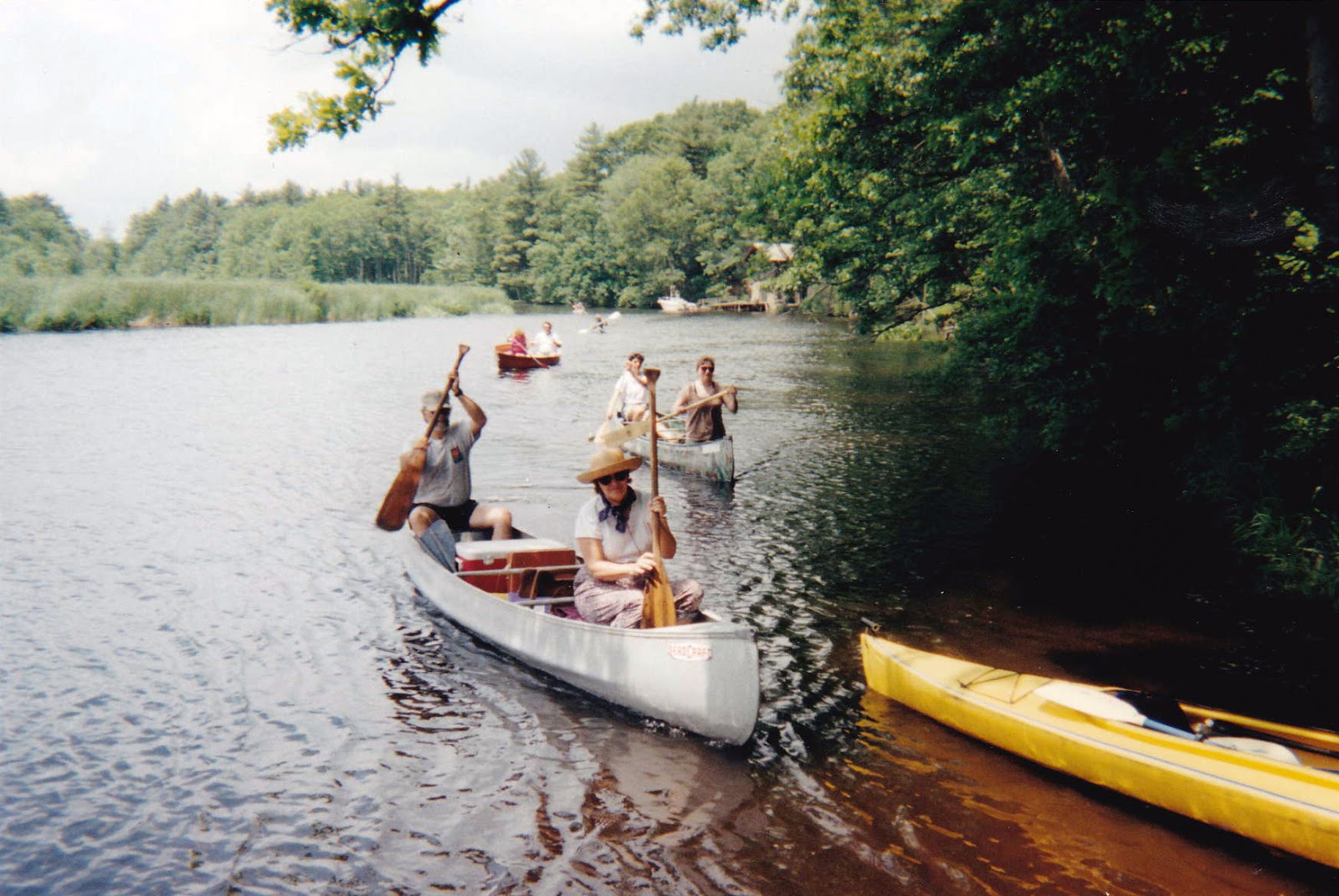
Canoeing on the North River.
(This article was originally published in September 2012. It was inadvertently left out of this blog.)

In mid-September, a high school friend was visiting from California. In planning her visit, she asked if we could go canoeing on the North River. I peeked at my calendar and was delighted to see that for the first time in at least seven years, this was actually possible for us. So we made our plan.

While I was looking forward to the canoeing itself, I was dreading the process of getting to and from the river: hauling my canoe up from the back yard; sorting through dust- (and mold) covered storage bins for straps, foam pads and other transport essentials; hoisting the boat onto my car and securing it sufficiently for the eight mile trip across town. Our time was limited. Wouldn’t it be better spent on the water?

And then I remembered a little wooden sign I’d seen, time and again, on Route 123 in Norwell. At Bulman Marine (you may remember it as King’s Landing), there were canoes and kayaks for rent – for full or half-days. A quick phone call confirmed that this was still the case, and suddenly we were looking forward to a most pleasant day on the North River, without any hassle.

The man on the phone explained to me how it worked. “It’s self-service,” he said. “Look for the box near the door of the main building. Posted next to it, you’ll find directions.” It’s $30 for a half-day and $50 for a full day. Cash or check.” Simple.

Indeed, upon arrival, we found a mailbox mounted on the outside of the building. In it were envelopes and release forms (one per person). We filled out the forms, added our payment, and dropped the sealed envelope through the mail slot. Next up: selecting our canoe.

This was easy. We only saw one. Plus quite an assortment of single and double occupancy kayaks. (Note: there is more than one canoe on site. The green ones are the rentals.)

We carried our boat toward the ramp, loaded our own gear (coolers and chairs for our picnic lunch, plus a dry bag containing our keys, IDs and phones), and then headed to the shed for paddles and personal flotation devices (PFDs). We slid the canoe down the ramp, hopped in, and pushed off.

It was nearing high tide on the North River that day, so we were able to ride the current upstream. Our destination was Couch Beach in North Marshfield, about an hour’s paddle, unless we encountered some wind. We did. But it was such a sunny, warm, and lovely day on the water, we didn’t mind. Not having seen each other for more a year, we had plenty to talk about.

In due time, we reached our beach. After hauling the canoe away from the high water line, we climbed up the embankment and unfolded our beach chairs at the edge of the pine forest. What a view! Before us was a panorama of marsh grass and sky, with the river in the foreground . . . one of my all-time favorite settings. We had a leisurely lunch, enjoying the novelty of being able just to chill out. And when we were sufficiently fed and rested, we headed back downstream. 

This time the wind was at our backs. We returned to the marina in half the time. All that was left to do was paddle up a small creek to the ramp, and pull the boat out of the water. Simple enough.

When we departed, there was a lot of water in the creek. When we returned, not so much. But it was still navigable. I steered us wrong and we ended up in the mud about halfway up the creek, so we shoved off and tried again. This time we got much farther in. 

My friend was in the bow. She leapt out of the boat to pull us to dry land, but then something went wrong. The river bottom was unexpectedly soft. The mud did not support her. She sank up to her knees, stumbling forward into the water and tipping the boat over in the process. I jumped out to right the boat and I too sank in the mud. 

We pushed the boat up onto the ramp, but by then we’d each sunken in up to our thighs. This was getting scary. I could barely pull my feet up from the mud. I wasn’t sure what to do, so I just kept scrambling toward shore. Eventually I was out, and my friend was right behind me – both of us soaked and completely covered in black mud.

We tipped the canoe again so we could get the water out, and then carried it up next to the shed, where there was a hose. After rinsing ourselves off, we cleaned out the boat as best we could, and put it back where we found it. It was then that we noticed the float, and dock, just a few feet farther downstream. Oh!

It turns out, we could have exited there, and not through the mud. Duly noted. It also turns out that the sign on the door (with the rules) happens to mention this at the bottom. It reads, “Do not launch or disembark in launch ramp at low tide. Mud is deep and messy. “ It wasn’t low tide – just mid-tide for us. But, oops! Now we know.

There definitely will be a next time. I’m not ruling out the use of my own canoe, but when time is tight and convenience is a factor (and the tides are working in our favor), renting from Bulman Marine is an appealing option. Here’s the rundown.

The rentals are first-come first served. On the phone, they told me it would be $30 to use a canoe for a half day, and $50 for a full day. But then the sign read $40 for a canoe rental, so that’s what we left in our envelope. According to the sign on the door, single kayaks are $30 and double kayaks are $40. PFDs and paddles, which are included, are stored in a nearby shed. For more information, call 781-659-7273.

by Kezia Bacon
September 2012

Kezia Bacon's articles appear courtesy of the North and South Rivers Watershed Association, a local non-profit organization devoted to the preservation, restoration, maintenance and conservation of the North and South Rivers and their watershed. For membership information and a copy of their latest newsletter, contact NSRWA at (781) 659-8168 or visit www.nsrwa.org. To browse 15 years of Nature (Human and Otherwise) columns, visit http://keziabaconbernstein.blogspot.com

Wednesday, May 2, 2018

A Visit to Stetson Meadows in Norwell

The meadow at Stetson Meadows Conservation Area
While enjoying one of NSRWA’s pontoon boat cruises last summer, I noticed a new bench in the woods in Norwell. Or maybe it was just new to me! The bench was nestled into the hillside, overlooking the North River, in the Stetson Meadows Conservation Area -- a place I hadn’t visited in over 15 years. I could vaguely recall reading about trail improvements at that site, but how long ago was that? It was time for a return visit. 

It’s so easy to forget about Stetson Meadows – so easy to be unaware that it exists. This is largely because of its location, tucked away in the woods, in a remote corner of Norwell accessible only by a single dirt road. Driving there, progressing carefully along uneven terrain, puts the visitor in a certain mindset. This is not a place to be raced to -- or through. One is inspired to slow down and savor the experience.

Stetson Meadows was established as conservation land in 1972. The Town of Norwell purchased the 184-acre property with the intention of providing public access, as well as to curb further development along the North River. Over the past 40 years, volunteers and the town have worked together to establish a network of trails. Now visitors can enjoy the property’s forests, meadows, wetlands, and woody swamps, along with impressive views of the salt marsh and the river. 


Beautiful and serene, the landscape of Stetson Meadows is also rich in history. Until it earned its own name in 1888, Norwell (also known as South Scituate) was part of the town of Scituate. Europeans began to settle there around 1628, with a large contingent arriving from County Kent, England, in 1633. Timothy Hatherly and the Conihasset partners received the first land grant, and the town itself was founded in 1636. Soon thereafter, settlers moved away from the rocky coast to the more accommodating interior, and built farms along the North River. While there were no formal roads back then, native tribes had created trails over the land. However it was often easier to travel by water, in small boats and canoes. The river was essentially the highway. 


The first European to lay claim to the area that is now Stetson Meadows was Robert Stetson, who received a 100-acre land grant in 1634. Stetson served the Crown of England for 14 years, attaining the rank of Cornet, a commissioned officer. He is remembered in posterity as a member of the contingent who established the boundary between the Plymouth and Massachusetts Bay colonies, as well as for leading a troop of soldiers in King Philips War, and for negotiating the purchase of Abington and Hanover from the Narragansett. 

In 1656, along with Timothy Hatherly and Joseph Tilden, Cornet Stetson established one of Plymouth Colony’s first sawmills. It was located on Third Herring Brook, at the foot of Old Pond, on what was commonly known as “the Old Indian Path,” (near the junction of present-day Tiffany Road and East Street). Sawmills were hugely important to the developing colonies, instrumental in the construction of dams and ships. 

The sawmill stood for 20 years but ultimately became a casualty of King Philips War. In 1676, as part of a three-year battle between the European Colonists and the native tribes, a party of Narragansetts and Nipmucks raided the area. They began their attack in Hingham, and then proceeded into Norwell and Hanover. They burned down Stetson’s sawmill, and continued east to Greenbush, destroying thirteen houses and barns along the way.

Cornet Stetson and his wife, Honor Tucker, had 10 children. Four of their sons  -- Joseph, Benjamin, Thomas and Samuel – eventually inherited the 100-acre land grant. Thomas farmed there, while in 1660, Benjamin established a shipyard on site at Bald Hill, just upstream of the present-day Route 3 bridge. Three generations of Stetsons worked the shipyard, which was eventually taken over by Nathaniel Church. The farm also passed down through subsequent generations, and was eventually sold to Michael Ford, a shipbuilder farther upstream at Fox Hill. Three generations of the Ford Family inhabited the farm, and then the Morton family, was the final owner before the town made its purchase.

These days, there isn’t much evidence on site of the Stetsons or any of the families who came after them. Forest and swamp now cover the farmland, although the occasional stone wall reminds the visitor of days past. It’s a lovely place to spend an hour or two. 


To get there, from River Street in Norwell, turn onto Stetson Shrine Lane. The paved road ends in a cul de sac. Continue on Meadows Farm Way, which is unpaved, for a half mile or so to get to the conservation area's parking lot. 

From there, cross the dirt road, and head downhill, along the meadow, toward the river. You’ll see a sign for the River Loop on the right. Follow the River Loop all the way around, and then continue downhill to the picnic area and the River Trail. Then follow the River Trail along the water and across Meadows Farm Way. You can access Twin Pines Trail from there, which you can either follow back to the parking lot, or extend your visit with a circuit of the loop of Stetson and Haskins Trails, another mile–plus through the woods.

Stetson Meadows borders private property in several places. It is important to be mindful of this, and remain on established trails. I recommend downloading the map/property guide from Norwell’s town website (https://www.townofnorwell.net/conservation-commission/pages/conservation-trail-brochures). You can also consult the informational kiosk in the property’s parking area.

by Kezia Bacon
April 2018

Kezia Bacon's articles appear courtesy of the North and South Rivers Watershed Association, a local non-profit organization devoted to protecting our waters. For membership information and a copy of their latest newsletter, contact NSRWA at (781) 659-8168 or visit www.nsrwa.org. To browse 20+ years of nature columns, visit http://keziabaconbernstein.blogspot.com

Wednesday, September 6, 2017

A Pontoon Boat Cruise on the North River

Looking downstream from the bow of the pontoon boat.
-->
If you’re reading this article, you are probably aware of the North and South Rivers -- two beautiful, healthy, tidal waterways whose watershed comprises much of the South Shore. Chances are, you’ve also spent some time there – perhaps by boat, or with a canoe, kayak or paddle board, or by walking in one of the numerous conservation areas that border them.

On the other hand, maybe you haven’t. Whether paddling trips and hikes aren’t your thing, or you have other reasons for not being able to access the rivers, I have good news to share with you. There’s another option! The North and South Rivers Watershed Association (NSRWA) now offers Pontoon Boat Cruises.

A pontoon boat is a motorized boat with a wide, flat deck, and plenty of room for upright seating. The deck is supported by two or three metal tubes (or pontoons), which provide flotation. While not the most aerodynamic, a pontoon boat moves quickly and deftly enough to provide a smooth, steady ride. The NSRWA’s boat – donated by a Marshfield family -- has comfortable bench seats in both the sun and the shade, all with a terrific view. Plus there’s no climbing – from the dock, you walk straight on and off the vessel. This is a very different experience from a kayak or a canoe.

Throughout the boating season (late spring til mid-autumn) NSRWA offers pontoon boat cruises several times per month. Each includes a licensed boat captain and a tour guide. You can choose the “Nature and History” themed cruise or just “Nature.” “Fall Foliage” and “River Wildlife” are other options. You can also charter your own.

In August, I signed up for one of the Nature and History-themed cruises. After registering online, I received my instructions, so I knew exactly where to park and what to bring. At 10:00am, I met my captain, guide, and fellow participants at Roht Marine, on the North River, on the Marshfield-Scituate line (Route 3A). After a brief safety overview, we were off.
I already knew a fair amount about the history of the North and South Rivers, but on the tour, I learned quite a bit more! Our guide explained how our region has changed since the last ice age – and how the rivers were formed. He discussed the first European settlers in our area and the ways in which they interacted with the native tribes who had been here for years. He explained salt marsh haying, and packet ships, and gave an overview of the local shipbuilding industry. He also discussed the ecology of the salt marsh, and pointed out some of the wildlife that make their home there. We saw marsh wrens, red tail hawks and osprey, and kept an eye out for bald eagles (they nest nearby.) There were maps and other visual aids to enhance the presentation, plus we were encouraged to “Ask anything.”

After an hour moving steadily upstream through gorgeous landscapes, we reached the Route 3 Bridge in Pembroke. The captain turned the boat around, and for most of our journey back to the starting point, we were encouraged to admire the view. This led to casual conversations among the participants and plenty more insights from the guide.

The 2-hour tour was extremely enjoyable. Time passed quickly. I found myself wanting to return, soon, with various friends and family members, especially those who aren’t inclined to experience the rivers in other ways. A Pontoon Boat Cruise would be a lovely way to mark a special occasion – a birthday or anniversary, for example, or a retirement. At $50 per person (for NSRWA members, $75 for non-members) it’s a bit of an investment, but well worth the cost.

If you’re interested in joining a Pontoon Boat Cruise, there are a number of them coming up this fall – nearly every weekend through the end of October. Most go upriver through Marshfield and Norwell, but some go downstream to The Spit. Visit nsrwa.org for details and to register.

by Kezia Bacon
August 2017


Kezia Bacon's articles appear courtesy of the North and South Rivers Watershed Association, a local non-profit organization devoted to protecting our waters. For membership information and a copy of their latest newsletter, contact NSRWA at (781) 659-8168 or visit www.nsrwa.org. To browse 20 years of nature columns, visit http://keziabaconbernstein.blogspot.com

A view from the stern of the pontoon boat.

Wednesday, January 4, 2017

7+ Walking Places for 2017

A view of Long Tom Pond at the Hoyt Hall Preserve in Marshfield.
-->
Every January, the North and South Rivers Watershed Association sponsors a New Year’s Day Walk. Typically this annual event -- which is free and open to the public -- showcases a recently acquired conservation area on the South Shore. But occasionally the event offers access to a privately owned property within the watershed. The 2017 walk is one of those occasions.

This year’s event, which begins at 1pm on Sunday January 1st, takes place at the Cardinal Cushing Centers in Hanover (405 Washington Street). Participants will follow trails through 100 acres of privately owned woodland to the Third Herring Brook, a rare opportunity to view the dam removal project that is currently in progress. For more information, visit www.nsrwa.org.

Whether or not NSRWA’s New Year’s Day Walk fits into your schedule, you may be looking for other places to take a stroll in 2017. We are fortunate, here on the South Shore, to have access to an abundance of nature preserves. Chances are, if walking in the woods is the type of thing you enjoy, you’re already familiar with World’s End in Hingham and the Norris Reservation in Norwell, local favorites that are both managed by The Trustees. You probably know the Mass Audubon properties too – Daniel Webster and North River Wildlife Sanctuaries, both in Marshfield.

What follows is a list of a few other lesser-known properties worthy of your attention. All are open to the public, generally from dawn until dusk. Before you go, visit the manager’s website to download a trail map.

Hoyt-Hall Preserve - Careswell Street/Route 139, Marshfield. This recently-opened preserve features several walking trails around Long Tom Pond and through 123 acres of woods, freshwater marsh and red cedar swamp, with links to the Old Colony Railroad and the Historic Winslow House. Managed by The Wildlands Trust.

Rockland Town Forest – North Avenue, Rockland. A small (39.5 acres) but truly special place to stretch one’s legs, the Rockland Town Forest’s narrow paths, boardwalks and bridges lead visitors through the wetlands that surround French Stream. This place is especially enchanting in the spring and summer when the trees and shrubs are leafy and green.

North Hill Marsh - Mayflower Street, Duxbury. A network of walking trails through pine and oak woodlands takes you all the way around the freshwater marsh and reservoir, with plenty of interesting vantage points. These 943 acres, managed by Mass Audubon and Duxbury Conservation, are prime territory for birding and other wildlife observation.

Wildcat Conservation Area – Circuit Street, Norwell. Over 100 quiet acres, with trails through the woods, and the occasional bench on which to pause and reflect. The narrow trails lead you past old stone walls and along historic Wildcat Hill. Managed by Norwell Conservation.

Weir River Farm and Turkey Hill – Turkey Hill Lane, Hingham.  Catch a glimpse of the agricultural landscape of days past on these 75 hilltop acres. The view of Boston Harbor is stunning. Plus there are pastures, woodland trails, and a working barnyard, with additional trails that link to Whitney & Thayer Woods. Managed by The Trustees.

• Bates Lane Conservation Area – Clapp Road, Scituate. This property and its surroundings comprise over 400 acres of contiguous conservation land in the West End of Scituate, most of it former farmland. A network of well-marked and well-tended trails leads through the woods, past glacial erratics and across small streams. Managed by Scituate Conservation.

Lansing Bennett Forest – Union Bridge Road, Duxbury. This historic property was once home to a sawmill and later a trout farm. Today it is 344 acres of mostly wooded upland, with glacial erratics and kettle holes, plus boardwalks that traverse the red cedar swamp that borders Phillips Brook. Managed by Duxbury Conservation.

by Kezia Bacon
December 2016

Kezia Bacon's articles appear courtesy of the North and South Rivers Watershed Association, a local non-profit organization devoted to the preservation, restoration, maintenance and conservation of the North and South Rivers and their watershed. For membership information and a copy of their latest newsletter, contact NSRWA at (781) 659-8168 or visit www.nsrwa.org. To browse 20 years of Nature (Human and Otherwise) columns, visit http://keziabaconbernstein.blogspot.com


Friday, July 1, 2016

Norwell’s Pathway and More

-->

The Pathway at Donovan Farm

I mentioned Norwell’s relatively new Pathway in an earlier article this year as something I was planning to investigate for a more detailed report. Investigation complete, I’m back with great news about all sorts of options for outdoor adventure and fun!

“The Pathway” in Norwell is a project that has been unfolding over the past few years. A network of paved cycling/walking trails, sidewalks and boardwalks, The Pathway provides an alternative to crossing town via Route 123. If you park near the Norwell Middle School (328 Main Street), you can travel more than a mile in either direction – west to the high school or east to the Norris Reservation. What’s more, there are a number of conservation properties along the route, offering various diversions.

Last month I had an opportunity to jog the entire length of the Pathway. If you leave your car in the lot at Gaffield Park, the playground at the corner of Forest and River Streets, you’ll be perfectly positioned for a round-trip Pathway journey. The Pathway is essentially a sidewalk along Forest Street, but it’s a nice new sidewalk!

A short distance past the playground, more or less across the street from 83 Forest Street, is Miller Woods, a 45-acre conservation area managed by the Town of Norwell. There is a small (4-car) parking area, and a network of walking trails through pine forest and red maple swamp. You could take a short walk around the first loop trail, or a longer one, going deeper into the property. All told, the average visitor could walk all of the trails in Miller Woods in about an hour.

The Pathway crosses Forest Street twice – before Miller Woods and a short distance after it. As you approach the intersection with Circuit and Pleasant Streets, you arrive at another town-managed open space parcel, the Donovan-Wildcat Conservation Area. If you travel the back roads of Norwell at all, you’re probably familiar with the Donovan property: acre upon acre of green fields, along with an historic farmhouse. The farm’s fields are leased for agricultural purposes, but there is a short trail around two sides of the perimeter – plenty of space to amble along and enjoy the view.

Just up Circuit Street, toward the Council on Aging, you’ll find an 8-car parking area on the left. This is a great starting point if you’d like to explore the larger, more diverse conservation lands around Wildcat Hill. Past the parking area and across Circuit Street, just a little farther up the road, look for two wooden posts with painted blazes in Norwell’s town colors, blue and gold. This is one of several trailheads for the Wildcat Conservation Area. 

A bench in Wildcat Conservation Area.

For Wildcat, which offers a number of intersecting loops trails, I recommend you download a brochure and map from the Town of Norwell’s website (see link below). You’ll pass along the back side of the Donovan farm, and then into the woods. Route-wise, there are numerous options, and most of them are marked with blue or white blazes. There are even a few wooden signs with arrows.

On the day of my visit, the property was a sea of green, with the trees in near-full leaf-out and ferns sprouting up everywhere. The woodlands are diverse – some pine, some maple, some beech – and at a few of the trail intersections, you’ll find a wooden bench for rest or contemplation. Eventually the trails connect with Wildcat Lane, where there is another small parking area. The trails are rough at some points. While they are relatively flat (with the exception of those that climb Wildcat Hill), they can be rocky. There’s evidence that they can be muddy at times as well.

One of many old stone walls in Wildcat Conservation Area.

Getting back to The Pathway, the intersection of Forest and Circuit Streets is where it becomes a true cycling and walking trail. Wider than the sidewalk, with marked lanes, The Pathway continues to the Middle School complex. Along the way, it skirts the edge of the Donovan fields, and then snakes through woods and wetlands, and even over streams (thanks to some beautifully-built boardwalks). 

One of the aforementioned boardwalks.
 
Eventually The Pathway emerges at the far edge of some of the town’s soccer and lacrosse fields, continues past the Transfer Station, and dips back into the woods for its final leg. Additional boardwalks and paved sections lead to Cushing Hill Road, a residential street that intersects with South Street. Across the road and down a short distance is Norwell’s high school/library complex.

If you have young cyclists in your family – children who are learning to ride a bike, who would enjoy the adventure of leaving the neighborhood – I recommend the middle section of The Pathway as an intermediate step before attempting larger parks like Wompatuck. Park at the Middle School.

And if you enjoy jogging (walking too!), I’m pleased to report that The Pathway is a great place to run. Starting at Gaffield Park, you’ll pretty much be going uphill the entire way, but that means on the way home, you’ll be heading downhill. It’s a pretty path, safe underfoot, and an excellent way to explore the town of Norwell.

Norwell’s Conservation Commission’s website is an excellent resource for all of the town’s open space properties. Now that I’ve found it, I’ll be exploring more of them in the months ahead. Follow this link for more information, and to download property guides and maps. http://www.townofnorwell.net/conservation-commission

by Kezia Bacon, Correspondent
June 2016

Kezia Bacon's articles appear courtesy of the North and South Rivers Watershed Association, a local non-profit organization devoted to the preservation, restoration, maintenance and conservation of the North and South Rivers and their watershed. For membership information and a copy of their latest newsletter, contact NSRWA at (781) 659-8168 or visit www.nsrwa.org. To browse 20 years of Nature (Human and Otherwise) columns, visit http://keziabaconbernstein.blogspot.com


Tuesday, March 8, 2016

Nature Walks & More: What’s New on the South Shore

The new dock (and my new paddle board) at Peter Igo Park in Brant Rock.
I’ve been writing this nature column for almost twenty years now. Thank you for reading it!

It seems that there is always something new to report – conservation land acquisitions, trail development, unusual occurrences like last year’s snowy owl “irruption.” While many of these topics are worthy of complete articles, and it’s likely I will follow up on them later in the year, I’d like to take this opportunity to get caught up on some noteworthy happenings from this past year.

• This summer Mass Audubon’s North River Wildlife Sanctuary (2000 Main Street, Marshfield) opened a new sensory trail. Designed for people who may not be able to enjoy a typical walk in the woods, the half-mile loop is ADA-compliant -- lined smoothly with gravel for easier walking or wheeling. It includes a post-and-rope guided trail, tactile displays for people with impaired vision, and signage in both large print and braille. Visitors are encouraged to use all of their senses to experience the outdoors – such as listening for birdsong, noticing the various scents in the air, or touching the bark of a tree.

• Also in Marshfield, good news for paddlers! The construction of a new dock at Peter Igo Park is complete. This means that kayakers, canoeists, rowers, and stand up paddle boarders, among others, now have easy access to the Green Harbor River (parking too). Check out this recently rehabilitated 17-acre park at the intersection of Dyke Road (Route 139) and Marshall Ave.

• “The Pathway” in Norwell is a project that has been unfolding over the past few years. A network of paved cycling/walking trails, sidewalks and boardwalks, The Pathway provides an alternative to crossing town via Route 123. If you park near the Norwell Middle School (328 Main Street), you can travel more than a mile in either direction – west to the high school or east to the Norris Reservation.

• There are a few conservation properties clustered together in Scituate’s West End, including the Bates Lane Conservation Area and the Litchfield Preserve. I had planned to write about this area for this month’s column, but the guided walk I’d signed up for was cancelled due to heavy snow and falling branches. I do hope to get there soon, so please stay tuned! These properties are located on Thomas Clapp Road. To park, look for a sign for Bates Lane and the Carl Pipes Memorial Trail. A second parking area is located at the Mount Hope Improvement Society building. There are a number of well-marked trails, plus the occasional wooden bench, a boardwalk style bridge, and a landmark known as Tepee Rock.

• In Plymouth, the Wildlands Trust has so much to offer. This past year the organization relocated its headquarters to the Davis-Douglas Farm and expanded its Halfway Pond Conservation Are to 418 acres. Nearby are the Six Ponds Preserve, the Emery Preserve, the Shifting Lots Preserve, and the South Triangle Pond Conservation Area. I’m hoping to explore several of these properties in the coming months, and I’ll report back to you with details. In the meantime, you can explore them on your own. Visit wildlandstrust.org for visitor information.

by Kezia Bacon
February 2016

Kezia Bacon's articles appear courtesy of the North and South Rivers Watershed Association, a local non-profit organization devoted to the preservation, restoration, maintenance and conservation of the North and South Rivers and their watershed. For membership information and a copy of their latest newsletter, contact NSRWA at (781) 659-8168 or visit www.nsrwa.org. To browse 20 years of Nature (Human and Otherwise) columns, visit http://keziabaconbernstein.blogspot.com


Tuesday, August 27, 2013

Boys in the Woods

-->
The Teeple, Morey, Beal and Bernstein children prepare for a walk at Willow Brook Farm Preserve in Pembroke.

Anyone who reads this column regularly knows that I enjoy a good walk in the woods. Dedicated readers also know that I have a son, Abel, who is now seven years old. I’ve been taking Abel for nature walks since he was an infant – first in a Baby Bjorn carrier, then in a jog stroller, and later with him walking along beside me. He really enjoyed these outings when he was little. Now, not so much. “It’s boring, Mom.”

But last spring I figured out a way to make it less boring. Invite friends. Not just one or two, but a whole pack of them. Boys plus woods equals fun! So this summer I planned a few group nature walks, inviting some of Abel’s friends and their families to join us at some of the more child-friendly local conservation properties. And I was delighted to see that it worked. The boys had fun . . . and the adults enjoyed themselves as well.

Our first exploration was at the Norris Reservation on Dover Street in Norwell, which is managed by The Trustees of Reservations. I’d picked up this year’s South Shore Quests booklet, so we followed the route suggested there, looking for clues that would ultimately reveal where the Quests box was hidden (an opportunity for us to sign a guest book and stamp our Quest passport). The clues gave us a compelling reason to carry on, despite some wet weather, but I’m not sure we even needed the incentive. The boys were quite happy to be scampering up and down the trails, finding and carrying big sticks, and looking for snakes and frogs – they found plenty of the latter. I didn’t bother to try to teach them anything about the land we were exploring – except when they asked, and they had some good questions – but instead I just let them absorb the forest environment, and enjoy themselves. And they did.

Our second trip followed another South Shore Quest, this time at Willow Brook Farm Preserve on Route 14 in Pembroke (the property is managed by the Wildlands Trust of Southeastern Massachusetts). The weather was better, and the boys (plus a couple girls this time) once again found simple ways to entertain themselves. Climbing on boulders and fallen trees was as big a hit as climbing the tall wooden observation tower. But it seemed like simply moving in a pack – there were eight or nine children altogether – was the real attraction. Something primal was happening among those kids – they really enjoyed being outside together, following a trail and some basic “stay within my sight” type of rules, but otherwise being able to make their own fun. We went on from that excursion to a stop at The Blueberry Farm in Hanson, for Pick Your Own berries, which made the day even more special.

I’m hoping to continue these group nature outings throughout the year. I do understand how a simple walk in the woods, even with plenty of flora and fauna to investigate, might not be all that appealing to a youngster, but I think we’re onto something here, with the group dynamic. If anything, it's a welcome alternative to all of the other organized activities these children participate in. Dance/art/music classes, sports, martial arts – and of course school – all have their place, but it’s really nice to be outdoors with the kids, doing nothing in particular except following a trail through the woods or a meadow, and seeing what the children are inspired to do.

by Kezia Bacon
August 2013

Kezia Bacon's articles appear courtesy of the North and South Rivers Watershed Association, a local non-profit organization devoted to the preservation, restoration, maintenance and conservation of the North and South Rivers and their watershed. For membership information and a copy of their latest newsletter, contact NSRWA at (781) 659-8168 or visit www.nsrwa.org. To browse 15 years of Nature (Human and Otherwise) columns, visit http://keziabaconbernstein.blogspot.com

Monday, July 6, 2009

Visiting the South Shore Natural Science Center


I have been writing this nature column for over fourteen years. Oddly, I have never featured Norwell’s South Shore Natural Science Center (SSNSC) in this space. What a tremendous oversight!

Do you know about the Science Center? It may qualify as one of the South Shore’s best-kept secrets. Founded in 1962, SSNSC has been active in environmental education for almost 50 years, working with area schools “to cultivate an awareness, appreciation and concern for” the natural world. They offer hands-on, interactive programs for preschoolers through Grade 12 -- in schools, at the Science Center, and at the beach and local nature preserves. They also offer programs for adults and families, throughout the year.

Originally knows as the South Shore Nature Center, the SSNSC got its start when a group of local naturalists and college professors, led by the renowned Norwell native, William G. (Cap’n Bill) Vinal, began running nature education programs out of a building in the town center. An old school bus named Flora brought children on field trips. In 1968, the group acquired land on Jacobs Lane in Norwell. The first Nature Center building, constructed in part by students from the South Shore Vocational-Technical High School, was dedicated in 1974. By then the Science Center was offering educational programs year-round.

Today the Science Center is comprised of a nature center on 30 acres, with six interpretive nature trails, and access to an additional 200 acres of conservation land. Outdoors there is also a summer house, an amphitheater, and a picnic area. Indoors includes a gallery, a greenhouse, a gift shop, classrooms and restrooms, and most notably, The EcoZone and other interactive exhibits.

Created with the help of South Shore native Jeff Corwin (of TV’s Animal Planet), and established in 2002, the EcoZone, is a multidimensional, interactive exhibit area that focuses on the ecosystems of southeastern Massachusetts, with special emphasis on wetlands habitat. Visitors can crawl through a hollow log and view a live pond – complete with frogs, fish and turtles -- from the bottom up; open tiny doors that reveal what plants and creatures inhabit a meadow; cross a wooden bridge; and learn first-hand about quaking bogs, vernal pools, nocturnal animals, and local reptiles and amphibians (snake-phobes, beware!).

Judging from my three-year-old son’s enthusiasm for the EcoZone, I’d say that it definitely helps to fulfill the SSNSC’s mission “to provide natural science experiences that educate, excite, and commit every generation to preserve the environment and to encourage responsible use, stewardship and enjoyment of our natural resource.”

The Science Center is also home to Bob the Iguana, a barred owl named Hedwig, an annual infusions of tiny red-bellied cooter turtles. Weekly programs such as Feed the Animals provide guests an opportunity to get up-close-and-personal with some of these creatures.

There’s always something going on at the Science Center. Vine Hall, the main gathering area, boasts a gallery of works by local artists that changes each month. The Nature Center Preschool runs throughout the school year – plus the Nature Adventures Summer Day Camp from June through August. Annual events such as Corn Festival, Maple Day, Perseid Showers Family Campout, Through the Garden Gate Garden Tour, the Water Watch Lecture Series (co-sponsored by Mass Audubon and NSRWA) and others provide entertainment and education for all ages. Visit www.ssnsc.org for a listing of current classes, programs, and events.

If you prefer a more solitary experience, be sure to check out the Science Center’s woodland trails. Most are easy hikes - perfect for families. Of particular note is the Tupelo Trail, a sensory trail developed for the blind and print handicapped, and the Sylvester Trail, which passes over a vernal pool. The trails are open every day, dawn to dusk (pets and smoking prohibited). Access is free of charge; you can pick up a map at the front desk. (Braille, large-print, and audio guides also available).

The South Shore Natural Science Center is located at 48 Jacobs Lane, off Route 123 in Norwell. Summer Hours (July and August) are Monday - Friday, 9:30 am - 4:30pm, and Saturday 9:30am - 1:00pm. Admission fees for indoor exhibits are $5.00 for adults, $3.00 for children (ages 2-15) & senior citizens (free for members). Admission to Vine Hall Art Gallery, the Nature Gift Store and the trails is always free for everyone.

By Kezia Bacon-Bernstein, Correspondent
June, 2009

Kezia Bacon-Bernstein's articles appear courtesy of the North and South Rivers Watershed Association, a local non-profit organization devoted to the preservation, restoration, maintenance and conservation of the North and South Rivers and their watershed. For membership information and a copy of their latest newsletter, contact NSRWA at (781) 659-8168 or visit www.nsrwa.org. To browse 13 years of Nature (Human and Otherwise) columns, visit http://keziabaconbernstein.blogspot.com.

Monday, May 19, 2008

Visiting Norwell’s Fogg Forest


Last January, I made the resolution that I would visit at least one new conservation parcel in 2007. I finally succeeded, in November, by going for a walk with my sister and my son at the 40-acre Fogg Forest in Norwell.

Fogg Forest is one of those places I have driven past for years, always intending to investigate, but never actually stopping to do so. The main entrance is located right on Main Street/Route 123. For years it was marked with a large wooden sign that read ‘Conservation Area,” although that sign is now gone.

From the street, the property just looks like a big grassy field. The grass is mowed regularly, so it doesn’t really appear to be the typical conservation place. But if you walk away from the road, toward the rear of the field, you will see another sign and the trailhead.

There you will find the main trail, which forms a half-mile loop as it passes through a mixed pine and hardwood forest, dotted here and there with large rhododendron shrubs and crumbling stone walls. It’s relatively easy walking – the trail is wide enough for a jog stroller, but not so wide that two adults can walk side by side.

From the main trail, you can explore several narrower, one-way trails that generally lead to private properties. One of these (take your second right once you’re on the main trail) leads to a bridge that crosses Black Pond Brook and eventually opens to the Central Street entrance to the property. According to the Town of Norwell’s website, it’s another half mile to Central Street.

If you prefer long walks, Fogg Forest probably isn’t the best choice for you. But if you don’t mind a shorter hike, or plan to spend most of your time birding or paying attention to the finer details of the woods, Fogg Forest is a quiet, relatively uncrowded place to stretch your legs. I’m sure it’s beautiful after a snowfall, too.

To Get There: From Norwell Center, proceed 1/4 mile west on Route 123 to the property. Look for a large grassy field. You can park along the roadside; there is room for about 4 cars. There is also access, along with benches and a picnic area, from Central Street, but no parking.

For a trail map, visit http://www.geocities.com/norwelltrails/fogg.html

By Kezia Bacon-Bernstein, correspondent
December 2007

Kezia Bacon-Bernstein's articles appear courtesy of the North and South Rivers Watershed Association, a local non-profit organization devoted to the preservation, restoration, maintenance and conservation of the North and South Rivers and their watershed. For membership information and a copy of their latest newsletter, contact NSRWA at (781) 659-8168 or visit www.nsrwa.org.

Monday, April 21, 2008

Where Does All That Water Go?

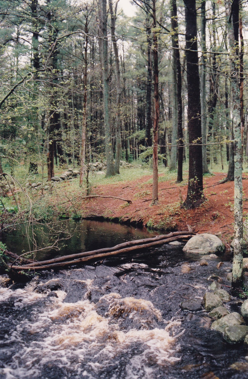
Second Herring Brook at the Norris Reservation in Norwell.
I probably would not have gone for a walk last Tuesday afternoon if I hadn’t remembered that Daylight Savings Time was due to begin. I’ve grown accustomed to taking a walk in the woods, along the river, or on the beach after work but now that the days are growing shorter, it will be all but dark when I leave the office at 5 PM. Walks will become morning and weekend events, as the return of Daylight Savings Time brings me back to my winter schedule.

This week’s walk took me to the Norris Reservation off Route 123 in Norwell. Managed by the Trustees of Reservations, this property is usually quite crowded at the end of the day, but with the rainy weather, the trails were practically deserted.

For those who may have forgotten, last weekend was the wet one. At least one Norwell resident measured six inches of rain on his backyard meter, and reports of local flooding were all over the news. Aside from some really big puddles however, I had yet to see any evidence of this influx of water. Driving over the North River around low tide on Monday afternoon, I noted that the river really didn’t look much different than usual.

My understanding of watershed mechanics changed as I walked down the path into the Norris Reservation. Through this 117-acre parcel flows Second Herring Brook, which drains Black Pond and a wide section of the eastern part of Norwell. Just below the mill pond on the property is a bridge, and below this bridge there is usually a quiet stream bubbling over the rocks, gently winding its way through the woods and emptying into the North River.

Last Tuesday it was different. I could hear the roar of the water as soon as I stepped down the path. Reaching the pond I was startled to see that both the pond and the brook had overflowed their banks, and that the quiet stream had turned into a raging torrent. A picnic table placed on a slight rise which usually affords a nice view of the brook was surrounded by swirling water. There was evidence that the flooding had been much worse the day before, as channels had been cut in the forest floor as the pond water attempted to escape its boundaries.

Thus my lesson in watershed mechanics. When it rains like crazy for three days straight, what happens to all that water? Some of it is absorbed into the ground, sometimes immediately, other times it stands in puddles for a while before slowly sinking in. But most of it flows over land. Downhill, into the wetlands, creeks, and little brooks that feed larger brooks, and from there into rivers like the North and South. The rivers flow to the ocean.

In the larger bodies of water we might not notice as dramatic a change as in the smaller ones -- a gallon of water poured into the Atlantic is far less noticeable than the same gallon poured on your basement floor -- but the change still occurs. The water has to go somewhere. While I could not detect much of a change in the North River estuary along Route 3A in Scituate, the difference in Second Herring Brook, one of its tributaries, was plain to see.

Driving home later that day I paid much more attention to the little brooks and streams that pass, unannounced, under our roads and highways. All of them were swollen, overflowing their banks and leaving big puddles in their wake. As I reached the South River in Marshfield Center I could hear the water raging in the distance. Looking upstream, I saw a most unusual sight. Veterans Memorial Park was under water! Furnace Brook and the upper reaches of the river were so full of water that they had flooded the park.

The area drained by a river or river system is known as a watershed. Basically, any rain that falls within the boundaries of a watershed stays within that watershed until it flows to sea. Portions of the towns of Abington, Duxbury, Hanover, Hanson, Hingham, Marshfield, Norwell, Pembroke, Rockland, Scituate, Weymouth, and Whitman drain into the North and South Rivers. While most of this drainage occurs in subtle ways, we really notice it when there’s a heavy rainfall.

by Kezia Bacon
November 1996

Kezia Bacon is the Assistant Director of the North and South Rivers Watershed Association (NSRWA).